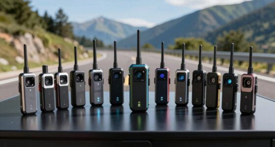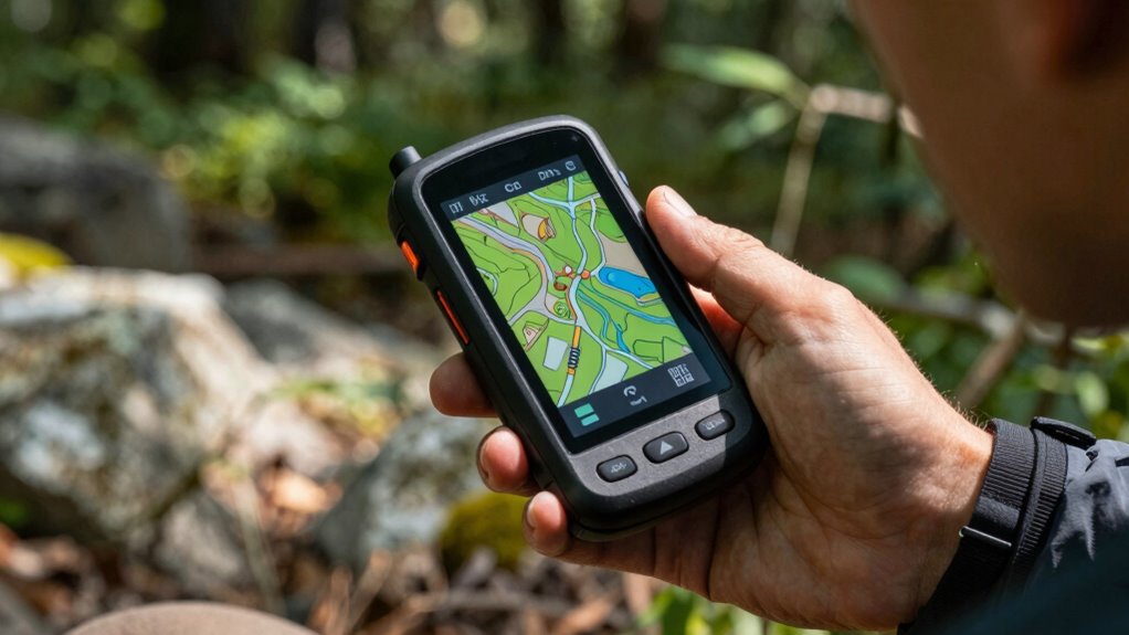
Finding the right handheld GPS for hiking and off-road use can be challenging, as options vary widely in features, durability, and price. The Garmin GPSMAP 66i stands out as the best overall choice thanks to its robust satellite communication and reliable navigation. For those seeking a more rugged, screen-focused device, the Garmin Montana 700i offers a larger touchscreen and extra durability. Budget-conscious hikers might prefer the Garmin eTrex 22x for its straightforward design and solid performance. Keep reading to see how these and other models compare, helping you make an informed decision for your outdoor adventures.

Get business pricing on garage and car supplies
- Business-only prices and quantity discounts
- Tax-exempt purchasing
- Multiple users, one account, clear invoices
Complete the kit


Key Takeaways
- Top models like the Garmin GPSMAP 66i combine advanced satellite communication with reliable navigation, making them ideal for remote off-road trips.
- Durability and water resistance are essential in choosing a GPS for rugged outdoor use, but they often come with increased weight and cost.
- Screen size and readability vary significantly; larger, sunlight-readable screens improve visibility in bright conditions but may reduce portability.
- Multi-GNSS support (GPS, GLONASS, Galileo) provides better accuracy and coverage, especially in challenging environments.
- Battery life remains a critical factor; devices with longer battery life are better suited for extended trips without access to charging.
| Garmin GPSMAP 65 Handheld GPS with Expanded Satellite Support and Multi-Band Technology |  | Best Overall for Reliable, Accurate Navigation in Challenging Environments | Screen Size: 2.6 inches | Display Type: LCD | Resolution: 160 x 240 | VIEW ON AMAZON | See Our Full Breakdown |
| Garmin GPSMAP 66i Handheld GPS and Satellite Communicator |  | Best for Communication and Navigation in Remote Areas | Screen Size: 3 inches | Display Resolution: 240 x 400 | Battery Life: 35 hours | VIEW ON AMAZON | See Our Full Breakdown |
| Garmin GPSMAP 67i Rugged Handheld GPS with inReach Satellite Technology |  | Best for Long-Duration Trips with Extensive Communication Needs | Display: 3-inch sunlight-readable color screen | Satellite Technology: inReach® Satellite | Messaging: Two-way messaging | VIEW ON AMAZON | See Our Full Breakdown |
| Garmin Montana 700i Rugged GPS Handheld with inReach Satellite Technology, 5″ Touchscreen (Renewed) |  | Best for Large Screen Navigation and Multi-Map Support | Screen Size: 5 inches | Supported Satellite Networks: GPS, Galileo | Connectivity: Wi-Fi, Bluetooth, ANT+ | VIEW ON AMAZON | See Our Full Breakdown |
| Handheld GPS for Hiking, Rugged and Waterproof Navigator with 3.2″ Sunlight Readable Screen and USA Topo Map |  | Best Compact, Waterproof GPS for Precise Navigation | Screen Size: 3.2 inches | Display Type: LCD | Battery Average Life: 36 hours | VIEW ON AMAZON | See Our Full Breakdown |
| Garmin eTrex 22x Handheld GPS Navigator |  | Best Overall for Rugged Outdoor Navigation | Display: 2.2-inch sunlight-readable color display | Resolution: 240 x 320 pixels | Preloaded Maps: Topo Active with routable roads and trails | VIEW ON AMAZON | See Our Full Breakdown |
| Garmin eTrex 10 Worldwide Handheld GPS Navigator |  | Best Value for Basic Outdoor Navigation | Display: 2.2 inches LCD, monochrome | Resolution: 128 x 160 | Preloaded Maps: Worldwide basemap | VIEW ON AMAZON | See Our Full Breakdown |
| Garmin eTrex 22x Rugged Handheld GPS |  | Best for Extended Trail Use with MicroSD Support | Display: 2.2-inch sunlight-readable color display | Resolution: 240 x 320 pixels | Preloaded Maps: TopoActive with routable roads and trails | VIEW ON AMAZON | See Our Full Breakdown |
| Garmin GPSMAP 64sx Handheld GPS with Altimeter and Compass |  | Best for Advanced Navigation with Sensors | Display: 2.6-inch sunlight-readable color display | Resolution: 240 x 320 pixels | Maps: Preloaded TopoActive maps (U.S. and Australia) | VIEW ON AMAZON | See Our Full Breakdown |
| Garmin Rino 750 Rugged Handheld 2-Way Radio and GPS Navigator |  | Best for Communication and Navigation in Challenging Environments | Display: 3-inch sunlight-readable touchscreen | Radio Range: Up to 20 miles | Satellite Support: GPS and GLONASS | VIEW ON AMAZON | See Our Full Breakdown |
| Garmin eTrex SE GPS Handheld Navigator |  | Best Budget-Friendly Choice for Reliable Basic Navigation | Screen Size: 2.2 inches | Display Resolution: 480 x 272 | Battery Life: 168 hours | VIEW ON AMAZON | See Our Full Breakdown |
| Garmin GPSMAP H1 Rugged Handheld GPS Navigator with Color Touchscreen and Long Battery Life |  | Best for Heavy-Duty, Extended Outdoor Use | Display: 3.5-inch color touchscreen | Battery Life: up to 145 hours | Water Resistance: IP67 | VIEW ON AMAZON | See Our Full Breakdown |
| Garmin eTrex 32x Rugged Handheld GPS Navigator |  | Best for Versatile, All-Environment Navigation | Screen Size: 2.2 inches | Display Resolution: 240 x 320 | Battery Life: up to 25 hours | VIEW ON AMAZON | See Our Full Breakdown |
| A6 Handheld GPS for Hiking, Multi GNSS Support, Rugged Navigator |  | Best Compact, Lightweight GPS for Basic Outdoor Navigation | Screen Size: 2.4 inches | Battery Life: up to 20 hours | Satellite Support: GPS, Galileo, BeiDou, QZSS | VIEW ON AMAZON | See Our Full Breakdown |
| S190 Handheld GPS Navigator with 3-Axis Compass and 64GB Storage |  | Best for Heavy-Duty, High-Storage Navigation | Display: 3.2 inches | Storage: 64 GB | Battery Life: 36 hours | VIEW ON AMAZON | See Our Full Breakdown |
| handheld gps for hiking and off road | Battery Life | Display |
|---|---|---|
| Garmin GPSMAP 65 Handheld GPS | 16 hours | — |
| Garmin GPSMAP 66i Handheld GPS | 35 hours | — |
| Garmin GPSMAP 67i Rugged Handh | Up to 165 hours in tracking mode | 3-inch sunlight-readable color screen |
| Garmin Montana 700i Rugged GPS | Supports extended use (specific hours vary) | — |
| Handheld GPS for Hiking | — | — |
| Garmin eTrex 22x Handheld GPS | Up to 25 hours | 2.2-inch sunlight-readable color display |
| Garmin eTrex 10 Worldwide Hand | Up to 20 hours | 2.2 inches LCD, monochrome |
| Garmin eTrex 22x Rugged Handhe | Up to 25 hours | 2.2-inch sunlight-readable color display |
| Garmin GPSMAP 64sx Handheld GP | Up to 16 hours | 2.6-inch sunlight-readable color display |
| Garmin Rino 750 Rugged Handhel | Up to 14 hours (lithium-ion), 18 hours (AA) | 3-inch sunlight-readable touchscreen |
| Garmin eTrex SE GPS Handheld N | 168 hours | — |
| Garmin GPSMAP H1 Rugged Handhe | up to 145 hours | 3.5-inch color touchscreen |
| Garmin eTrex 32x Rugged Handhe | up to 25 hours | — |
| A6 Handheld GPS for Hiking | up to 20 hours | — |
| S190 Handheld GPS Navigator wi | 36 hours | 3.2 inches |
More Details on Our Top Picks
Garmin GPSMAP 65 Handheld GPS with Expanded Satellite Support and Multi-Band Technology
The Garmin GPSMAP 65 stands out for its multi-band GNSS support and expanded satellite compatibility, making it particularly effective in dense forests and rugged terrain where signal accuracy is a challenge. Unlike the GPSMAP 66i, it lacks satellite communication features, but it offers detailed preloaded TopoActive maps and a sunlight-readable display, ensuring dependable navigation without connectivity concerns. The 2.6-inch LCD is smaller than the 66i’s 3-inch screen, which may be less ideal for quick glances, but its longer battery life of 16 hours makes it suitable for extended hikes. This device makes sense for users who prioritize precise location data in remote areas but don’t need communication features. Its button-based interface, however, might feel outdated compared to touchscreens, and map coverage is limited to North America.
Pros:- Enhanced accuracy with multi-band GNSS and expanded satellite support
- Bright, sunlight-readable 2.6-inch color display
- Preloaded with detailed TopoActive maps and public land boundaries
- Long battery life of up to 16 hours
Cons:- Button-operated design may be less intuitive for some users
- Limited to North America map coverage
Best for: Hikers and off-road enthusiasts who need highly accurate positioning and detailed maps without the distraction of satellite communication.
Not ideal for: Backcountry explorers requiring two-way messaging or emergency communication, as it lacks satellite texting features.
- Screen Size:2.6 inches
- Display Type:LCD
- Resolution:160 x 240
- Battery Life:16 hours
- Connectivity:Bluetooth, ANT
- Supported Maps:Preloaded TopoActive maps, federal public land map (U.S. only)
Our verdict“This device is ideal for users seeking reliable, precise navigation in remote hiking or off-road scenarios without communication features.”
Garmin GPSMAP 66i Handheld GPS and Satellite Communicator
The Garmin GPSMAP 66i combines rugged navigation with inReach satellite communication, making it the top choice for those who need both precise location data and emergency contact capabilities. Its larger 3-inch display offers clearer visibility, especially compared to the Montana 700i’s 5-inch screen, and supports two-way messaging and interactive SOS. While its long 35-hour battery life is impressive, the need for an active satellite subscription can add ongoing costs. Compared to the GPSMAP 65, it includes more comprehensive communication tools, but it’s less suitable for users who only need basic navigation. This makes it perfect for backcountry adventurers who want peace of mind knowing they can signal for help from anywhere, but casual hikers might find it overkill.
Pros:- Rugged design suitable for outdoor adventures
- Preloaded maps and satellite imagery support detailed navigation
- Long battery life of up to 35 hours
- Includes emergency SOS and two-way satellite messaging
Cons:- Requires satellite subscription for messaging features
- Higher purchase price for specialized satellite communication
Best for: Backcountry travelers and off-road explorers who require reliable communication and navigation in areas without cell service.
Not ideal for: Casual hikers or day-trippers who do not need satellite messaging or emergency features, as the device’s complexity and cost may be excessive.
- Screen Size:3 inches
- Display Resolution:240 x 400
- Battery Life:35 hours
- Connectivity:Cellular, Satellite (Iridium), GPS
- Map Features:Preloaded TopoActive maps, Satellite imagery downloads
- Supported Devices:Smartphone
Our verdict“This device is best for users who need dependable navigation coupled with satellite communication for remote outdoor activities.”
Garmin GPSMAP 67i Rugged Handheld GPS with inReach Satellite Technology
The Garmin GPSMAP 67i excels in extended outdoor expeditions thanks to its massive battery life—up to 165 hours in tracking mode—and its support for global satellite communication via inReach technology. Its 3-inch sunlight-readable screen offers clear visuals, even in bright sunlight, and it supports two-way messaging, interactive SOS, and detailed topo maps. Compared with the Montana 700i, it provides longer battery life and a more straightforward interface, though it requires an active subscription for satellite services. This device suits serious adventurers planning multi-day trips who need dependable navigation and emergency communication. Casual hikers or those with shorter trips might find the device’s complexity and cost unnecessary.
Pros:- Massive battery life supports extended trips
- Supports global satellite communication and emergency SOS
- Preloaded topographic maps and satellite imagery
- Rugged, durable design
Cons:- Requires active subscription for satellite features
- Relatively high cost
- Some features may be complex for casual users
Best for: Long-distance hikers and off-road explorers needing extended battery life and reliable satellite communication.
Not ideal for: Casual users or short-term hikers who do not require satellite messaging or extensive mapping features.
- Display:3-inch sunlight-readable color screen
- Satellite Technology:inReach® Satellite
- Messaging:Two-way messaging
- SOS:Interactive SOS via Garmin Response
- Battery Life:Up to 165 hours in tracking mode
- Subscription Required:Yes
Our verdict“This device is perfect for serious outdoor enthusiasts who need long-lasting power and global satellite communication capabilities.”
Garmin Montana 700i Rugged GPS Handheld with inReach Satellite Technology, 5″ Touchscreen (Renewed)
The Garmin Montana 700i offers a large 5-inch touchscreen, making it easier to view detailed maps and manage routes, especially compared to smaller models like the GPSMAP 65. Its rugged, military-grade construction supports multiple satellite systems, including GPS and Galileo, for high-precision positioning. The inReach technology provides two-way messaging and SOS, making it suitable for multi-day outdoor adventures. However, being a renewed product, it may have limited warranty, and its higher price point reflects its premium features. It’s ideal for users who want a big, user-friendly display combined with satellite communication but may be overkill for casual day hikers or those on a tight budget.
Pros:- Large, easy-to-navigate 5-inch touchscreen
- Supports multiple GNSS systems for precise positioning
- InReach satellite technology for SOS and messaging
- Supports detailed topographical and street maps
Cons:- Active satellite subscription required for inReach features
- Refurbished condition may limit warranty
- Higher cost compared to smaller models
Best for: Adventurers seeking a large, easy-to-use touchscreen device with reliable satellite communication for extended trips.
Not ideal for: Casual hikers or those preferring smaller, simpler devices without extensive map features or satellite communication.
- Screen Size:5 inches
- Supported Satellite Networks:GPS, Galileo
- Connectivity:Wi-Fi, Bluetooth, ANT+
- Additional Features:Routable Topo Maps, inReach Satellite
- Battery Life:Supports extended use (specific hours vary)
- Operating System:Windows
Our verdict“This device is best for users who need a sizable display and reliable satellite communication for serious outdoor navigation.”
Handheld GPS for Hiking, Rugged and Waterproof Navigator with 3.2″ Sunlight Readable Screen and USA Topo Map
The Handheld GPS with a 3.2-inch sunlight-readable display offers a practical balance of size and functionality. Its support for multiple GNSS systems ensures high accuracy in off-road situations, and preloaded USA Topo maps make it suitable for day hikes and short trips. Compared with the Montana 700i, it lacks a touchscreen and satellite communication, making it more straightforward but less versatile in complex scenarios. Its waterproof design adds durability, yet the absence of a touchscreen can slow navigation or route adjustments. This model makes the most sense for users who prefer a simple, rugged device focused solely on reliable navigation in the US.
Pros:- Bright sunlight-readable 3.2-inch display
- Supports multiple GNSS for high accuracy
- Water-resistant and rugged build
- Preloaded USA Topo maps for precise navigation
Cons:- No touchscreen interface, which can slow operation
- Requires USB-C for charging
- Limited functionality compared to more advanced models
Best for: Hikers and outdoor enthusiasts who need a durable, straightforward GPS with excellent sunlight visibility for US terrains.
Not ideal for: Users seeking advanced communication features or a touchscreen interface for ease of use.
- Screen Size:3.2 inches
- Display Type:LCD
- Battery Average Life:36 hours
- Map Types:Topographical
- Supported Satellite Navigation System:BeiDou, GPS, Galileo, QZSS
- Operating System:Windows
Our verdict“This GPS is well-suited for US-based hikers needing a reliable, rugged, and straightforward navigation device without extra communication features.”
Garmin eTrex 22x Handheld GPS Navigator
The Garmin eTrex 22x stands out as the best overall choice for serious hikers and off-road enthusiasts who need a durable device with reliable mapping. Its rugged design ensures it withstands rough conditions, while the preloaded Topo Active maps provide detailed routing for trails and roads. Compared to the Garmin eTrex 10, it offers a brighter, color display and better map detail, but it still relies on AA batteries, which may require frequent replacement during extended trips. The small 2.2-inch screen limits map visibility for some users, though its support for GPS and GLONASS improves tracking accuracy. This device makes the most sense for those who prioritize durability and detailed topo maps over a larger display or longer battery life.
Pros:- Rugged and durable construction for tough environments
- Preloaded with detailed Topo Active maps for comprehensive navigation
- Supports multiple satellite systems for improved accuracy
Cons:- Relies on AA batteries, which may need frequent replacement
- Small display size may be limiting for detailed map viewing
Best for: Backcountry hikers and mountain bikers needing a tough, map-rich GPS device for extended outdoor use
Not ideal for: Casual walkers or day hikers who prefer larger screens and longer battery life in a less rugged form factor
- Display:2.2-inch sunlight-readable color display
- Resolution:240 x 320 pixels
- Preloaded Maps:Topo Active with routable roads and trails
- Satellite Support:GPS and GLONASS
- Internal Memory:8 GB
- Battery Life:Up to 25 hours
Our verdict“This device is perfect for experienced outdoor users who need a compact, durable GPS with detailed topo maps and reliable satellite support.”
Garmin eTrex 10 Worldwide Handheld GPS Navigator
The Garmin eTrex 10 offers a reliable, no-frills GPS experience at an accessible price point, making it ideal for beginners or casual users. Its monochrome display, while less vibrant than color screens like the Garmin eTrex 22x, simplifies navigation with a clear, easy-to-read interface. The preloaded worldwide basemap helps with global travel, but the limited internal storage of only 6 MB means it’s not suited for extensive map downloads. Compared with the Garmin GPSMAP 64sx, it lacks additional sensors such as a compass or altimeter but compensates with solid waterproofing and long battery life. This device suits those who need straightforward GPS with minimal fuss, even if it sacrifices some detail and advanced features.
Pros:- Durable, waterproof design for tough outdoor conditions
- Long battery life of up to 20 hours with AA batteries
- Preloaded worldwide basemap simplifies initial navigation
Cons:- Monochrome display offers less detail and visibility in sunlight
- Limited internal storage makes map updates or downloads difficult
Best for: Hikers and outdoor explorers new to GPS technology or those on a tight budget
Not ideal for: Advanced users needing detailed topographic maps or additional sensors like a barometric altimeter
- Display:2.2 inches LCD, monochrome
- Resolution:128 x 160
- Preloaded Maps:Worldwide basemap
- Battery Life:Up to 20 hours
- Connectivity:Wired USB
- Water Resistance:Waterproof
Our verdict“Ideal for entry-level users seeking simple, reliable GPS navigation without extra bells and whistles.”
Garmin eTrex 22x Rugged Handheld GPS
The Garmin eTrex 22x Rugged expands on the original model with a larger internal storage (8 GB) and microSD card support, making it better suited for those who want to load multiple detailed maps. Its sunlight-readable color display offers improved visibility over basic monochrome units, though the 2.2-inch size remains compact for portability. Compared to the Garmin eTrex 10, it provides much richer map detail and longer battery life—up to 25 hours—yet still depends on AA batteries, which could be inconvenient during long trips. While it excels in durability and map flexibility, the limited display resolution might hinder detailed map viewing. This makes it a smart choice for users who need detailed topo maps without sacrificing ruggedness or portability.
Pros:- Supports microSD cards for additional map storage
- Long battery life of up to 25 hours
- Rugged and sunlight-readable display for outdoor conditions
Cons:- Display resolution is relatively basic for detailed maps
- Requires AA batteries, which may need frequent replacement
Best for: Experienced hikers and off-roaders needing expandable maps and long battery life
Not ideal for: Casual users or those preferring large screens and minimal map management
- Display:2.2-inch sunlight-readable color display
- Resolution:240 x 320 pixels
- Preloaded Maps:TopoActive with routable roads and trails
- Internal Memory:8 GB
- Battery Life:Up to 25 hours
- Additional Features:Supports microSD cards
Our verdict“This device suits serious outdoor users who want expandable maps and durable, portable navigation at a reasonable price.”
Garmin GPSMAP 64sx Handheld GPS with Altimeter and Compass
The GPSMAP 64sx is tailored for serious outdoor explorers who need comprehensive navigation tools, including a 2.6-inch sunlight-readable color screen, a 3-axis compass, and a barometric altimeter. Its support for multiple satellite systems, including GPS, GLONASS, and Galileo, provides superior accuracy, especially in challenging environments. Compared with the Garmin eTrex 22x, it offers a larger display and built-in sensors, but at a higher price point and with a somewhat bulkier form factor. The device’s water resistance and long 16-hour battery life make it suitable for extended trips, though the smaller map preloaded scope limits global coverage. This is ideal for advanced users who need detailed sensors and multi-GNSS support in a rugged package.
Pros:- Supports multiple satellite systems for enhanced accuracy
- Includes a 3-axis compass and barometric altimeter
- Water-resistant and rugged for tough conditions
Cons:- Limited to U.S. and Australian maps preloaded
- Higher cost and slightly larger size can be less portable
Best for: Backcountry hikers and off-roaders requiring precise sensors and multi-GNSS tracking
Not ideal for: Casual hikers or those on a budget who don’t need detailed sensors or extensive map options
- Display:2.6-inch sunlight-readable color display
- Resolution:240 x 320 pixels
- Maps:Preloaded TopoActive maps (U.S. and Australia)
- Connectivity:Bluetooth and ANT+
- Battery Life:Up to 16 hours
- Additional Features:Altimeter, 3-axis compass
Our verdict“This device is best for advanced outdoor users who require sensors and multi-GNSS support for precise navigation.”
Garmin Rino 750 Rugged Handheld 2-Way Radio and GPS Navigator
The Rino 750 combines GPS navigation with a 2-way radio, making it ideal for team-based outdoor activities like off-road adventures or remote trail patrols. Its 3-inch sunlight-readable touchscreen offers a more sizable display for map viewing, while the dual battery options extend operational hours up to 18 hours with AA batteries or 14 with lithium-ion. The high-sensitivity GPS and GLONASS ensure precise positioning, and the radio’s 20-mile range facilitates communication in large, rugged areas. Compared to standalone GPS devices like the Garmin eTrex 22x, it offers the added advantage of real-time team communication, but it requires compatible devices for sharing locations and the optional AA batteries are sold separately. This makes it suitable for coordinated outdoor work or group adventures where communication is as critical as navigation.
Pros:- Up to 20 miles of radio range for team communication
- High-sensitivity GPS and GLONASS for accurate positioning
- Long battery life with dual power options
Cons:- Requires compatible devices for location sharing
- Optional AA batteries sold separately
Best for: Outdoor teams, search and rescue, or off-road groups needing reliable communication alongside GPS
Not ideal for: Solo hikers or casual users who only need basic navigation without radio features
- Display:3-inch sunlight-readable touchscreen
- Radio Range:Up to 20 miles
- Satellite Support:GPS and GLONASS
- Battery Life:Up to 14 hours (lithium-ion), 18 hours (AA)
- Additional Features:Location sharing, voice control
Our verdict“This device is ideal for groups requiring both reliable GPS navigation and robust radio communication in remote environments.”
Garmin eTrex SE GPS Handheld Navigator
The Garmin eTrex SE stands out for its exceptional battery life, supporting up to 168 hours on just two AA batteries, which makes it ideal for extended outdoor trips where charging options are limited. Its support for multiple GNSS systems, including GPS, GLONASS, and Galileo, provides better accuracy in challenging terrains compared to simpler devices like the Garmin eTrex 10. However, its small 2.2-inch display and limited North America-only maps mean it’s less suited for users who need detailed, large-screen mapping in remote areas. Wireless features like Bluetooth and USB facilitate updates and geocaching, but the device’s reliance on AA batteries (not included) can be a downside for frequent travelers. This pick makes the most sense for budget-conscious hikers who prioritize battery longevity and multi-satellite support over detailed maps or large screens.Pros:- Exceptional battery life supports extended trips
- Supports multiple satellite systems for better accuracy
- Water-resistant and rugged build withstands tough conditions
- Wireless connectivity for updates and geocaching
Cons:- Requires AA batteries, which are not included and may need frequent replacements
- Limited to North America maps, reducing usability in other regions
- Small screen size may hinder detailed map viewing
Best for: Hikers and outdoor enthusiasts seeking reliable, long-lasting basic navigation with minimal extra features
Not ideal for: Users who need detailed maps or a larger display for complex navigation or planning
- Screen Size:2.2 inches
- Display Resolution:480 x 272
- Battery Life:168 hours
- Battery Type:2 AA batteries (not included)
- Water Resistance:IPX7
- Supported GNSS:GPS, GLONASS, Galileo, BeiDou, QZSS
Our verdict“This device is best for budget-conscious adventurers who need reliable basic navigation and long battery life.”
Garmin GPSMAP H1 Rugged Handheld GPS Navigator with Color Touchscreen and Long Battery Life
The Garmin GPSMAP H1 excels in durability, featuring a MIL-STD 810 rated build and IP67 water resistance, making it ideal for harsh environments where other handhelds might falter, such as the Garmin eTrex 32x. Its 3.5-inch sunlight-readable touchscreen offers easier map interaction compared to smaller screens, though this may make it bulkier for lightweight backpackers. The device’s long battery life—up to 145 hours in GPS mode and 840 hours in expedition mode—supports multi-day adventures without concern for power. Preloaded topographic maps combined with safety tools like a flashlight and siren make it a comprehensive survival companion, but its size and complexity might overwhelm casual users or those seeking simple devices. This model suits serious outdoor explorers who need durable gear with advanced navigation and safety features.Pros:- Rugged, MIL-STD 810 rating withstands tough conditions
- Long-lasting battery supports extended trips
- Bright, large touchscreen simplifies navigation
- Preloaded topographic maps and safety tools enhance outdoor safety
Cons:- Relatively large and potentially cumbersome for some users
- Complex features require a learning curve
- Price likely higher due to advanced durability and features
Best for: Professional hikers, hunters, or outdoor workers needing ruggedness, long battery life, and detailed maps
Not ideal for: Casual hikers or those preferring lightweight, straightforward devices with minimal features
- Display:3.5-inch color touchscreen
- Battery Life:up to 145 hours
- Water Resistance:IP67
- Durability:MIL-STD 810 rated
- Maps:Preloaded TopoActive maps
- Additional Features:Built-in flashlight and siren
Our verdict“Best suited for demanding outdoor professionals who require durability, long endurance, and detailed mapping capabilities.”
Garmin eTrex 32x Rugged Handheld GPS Navigator
The Garmin eTrex 32x combines rugged durability with detailed mapping, supporting both GPS and GLONASS for improved tracking in difficult environments, outperforming basic models like the eTrex 10. Its 2.2-inch color display with 240 x 320 resolution is small but functional, especially with preloaded Topo Active maps ideal for hiking and cycling. The inclusion of a 3-axis compass and barometric altimeter enhances navigation accuracy when GPS signals are unreliable, though its limited internal storage of 8GB may require microSD expansion for extensive maps. Battery life of up to 25 hours is decent but less than some longer-lasting devices. It’s best for users who need a rugged, reliable, and feature-rich handheld but are comfortable with a smaller screen and managing storage.Pros:- Rugged and durable for tough outdoor conditions
- Supports dual satellite systems for improved accuracy
- Includes 3-axis compass and barometric altimeter
- Preloaded with detailed topographical maps
Cons:- Small screen size can be challenging for detailed map viewing
- Limited internal storage, requiring microSD card for more maps
- Requires 2 AA batteries, which may need frequent replacement
Best for: Serious hikers and cyclists needing a compact, durable device with advanced navigation tools
Not ideal for: Beginners or those seeking large, easy-to-read maps without microSD management
- Screen Size:2.2 inches
- Display Resolution:240 x 320
- Battery Life:up to 25 hours
- Supported Satellite Systems:GPS and GLONASS
- Additional Features:3-axis compass, barometric altimeter
- Maps:Preloaded Topo Active
Our verdict“Ideal for experienced outdoor users who prioritize ruggedness and advanced navigation tools in a compact form.”
A6 Handheld GPS for Hiking, Multi GNSS Support, Rugged Navigator
The A6 Handheld GPS offers a compact and lightweight design, making it appealing for those who want essential navigation without bulk, unlike larger rugged devices such as the GPSMAP H1. Its 2.4-inch color screen is bright and easy to read, supporting multiple satellite systems—GPS, Galileo, BeiDou, and QZSS—for accurate positioning. The device’s 20-hour battery life is decent for day hikes, but it lacks preloaded maps, relying instead on manual waypoint and track recording, which limits its usability for detailed navigation. Its absence of a touchscreen and maps means it’s best for outdoor enthusiasts comfortable with basic navigation. This model suits hikers seeking a simple, reliable tool for quick, on-the-go positioning without the frills.Pros:- Supports multiple satellite systems for accurate positioning
- Lightweight and rugged, easy to carry
- Long battery life of up to 20 hours
- Includes essential navigation tools like compass and altimeter
Cons:- No preloaded maps, limiting navigation options
- Requires a clear view of the sky for optimal satellite signals
- No touchscreen or advanced mapping features
Best for: Lightweight hikers and outdoor adventurers needing simple, dependable GPS with multi-GNSS support
Not ideal for: Users who want detailed maps or touchscreen functionality for complex navigation
- Screen Size:2.4 inches
- Battery Life:up to 20 hours
- Satellite Support:GPS, Galileo, BeiDou, QZSS
- Features:GPS compass, barometric altimeter, waypoint recording
- Maps:No maps included
Our verdict“Suitable for minimalists who need a straightforward, durable GPS device for basic outdoor use.”
S190 Handheld GPS Navigator with 3-Axis Compass and 64GB Storage
The S190 offers extensive storage and a durable build, making it suitable for users who need to carry a large collection of maps and data, unlike lighter, simpler options like the A6. Its 3.2-inch sun-readable display ensures visibility in bright conditions, and the 64GB of storage supports multiple detailed maps, although zooming may require additional downloads. The device’s rugged construction and 36-hour battery life suit extended adventures, and the preloaded USA Topo maps enhance off-road navigation. However, its smaller screen size and the need for manual map management make it less user-friendly for quick glance navigation than larger, more intuitive screens. This device caters to serious off-roaders and hikers who prioritize storage capacity and durability over simplicity.Pros:- Rugged, durable design withstands tough conditions
- Large 64GB storage supports extensive maps and data
- Preloaded with USA Topo maps for off-road use
- Supports multiple satellite systems for accurate positioning
Cons:- Small screen size may limit map readability
- Requires manual map downloads for high-detail views
- Limited zoom functionality without additional map downloads
Best for: Outdoor explorers needing a rugged device with large storage for extensive maps and data
Not ideal for: Casual users or those preferring large, easy-to-read screens with preloaded detailed maps
- Display:3.2 inches
- Storage:64 GB
- Battery Life:36 hours
- Additional Features:3-axis compass, sun-readable screen
- Maps:Preloaded USA Topo
Our verdict“Best for serious off-road enthusiasts who need substantial storage and rugged durability for extended trips.”

How We Picked
Products were selected based on a combination of performance, durability, usability, and value for hiking and off-road use. We prioritized models with multi-GNSS support, rugged build quality, and reliable battery life, ensuring they can withstand outdoor conditions. Features like screen readability, ease of interface, and additional communication capabilities were also considered, as these impact usability in remote areas. The ranking reflects a balance of price, features, and overall reliability for various outdoor scenarios, from casual day hikes to serious off-road adventures.Factors to Consider When Choosing Handheld Gps For Hiking And Off Road
Choosing the right handheld GPS involves weighing several factors beyond basic features. Durability and water resistance are vital for off-road conditions, while screen readability can affect usability in bright sunlight. Battery life determines how long you can rely on the device without recharging, especially in remote locations. Support for multiple satellite systems improves accuracy in challenging environments. Lastly, consider additional features like communication tools or topographical maps, which can enhance your experience and safety.Durability and Water Resistance
For off-road and hiking adventures, a rugged, waterproof design is non-negotiable. Devices with military-grade durability or IP ratings are better suited to withstand drops, shocks, and exposure to water. Be mindful that increased durability often adds weight and cost, so balance your need for ruggedness with portability and budget constraints.
Screen Readability and Size
Clear, sunlight-readable screens make a big difference when navigating in bright outdoor environments. Larger screens provide more detail and easier legibility but can compromise portability and weight. Consider your typical hiking conditions and whether you prefer a compact device or a larger display for detailed maps.
Battery Life
Extended battery life is essential for long trips, especially if you plan to be away from power sources for days. Look for GPS units with replaceable batteries or those that support external power options like portable chargers. Keep in mind that features like backlight use and continuous tracking can drain batteries faster, so choose a device with a balance of features and stamina.
Multi-GNSS Support
Devices supporting multiple satellite systems—such as GPS, GLONASS, and Galileo—offer better accuracy and reliability in challenging environments like dense forests or deep canyons. Not all handheld GPS units support these systems, so check this feature if you often hike in difficult terrain or off the beaten path.
Additional Features
Extras like preloaded topographical maps, GPS-based navigation aids, or satellite communication can significantly enhance your experience. Some models include two-way messaging or emergency SOS features, which are crucial for safety in remote areas. Consider your specific needs and how these extras could add value to your adventures, especially if you venture into less accessible locations.
Frequently Asked Questions
Can I use a handheld GPS without cell service in remote areas?
Yes, most handheld GPS devices operate independently of cell service because they rely on satellite signals for positioning. Devices with built-in satellite communication, like the Garmin GPSMAP 66i, also provide emergency messaging and tracking capabilities, which are invaluable in remote locations. Always verify the device’s satellite support and battery life to ensure it meets your specific off-grid needs.
How important is multi-GNSS support for off-road hiking?
Multi-GNSS support can significantly improve navigation accuracy and reliability, especially in challenging environments like dense forests or deep valleys. Devices that support multiple satellite systems can lock onto signals more quickly and maintain position better when conditions are less than ideal. For serious off-road enthusiasts, this feature often justifies a higher price point due to the improved performance and peace of mind it offers.
Should I prioritize screen size or battery life in my choice?
This depends on your typical trip duration and preferences. Larger, sunlight-readable screens make map reading easier on the trail, but they tend to drain batteries faster. If you usually hike for multiple days without recharge options, opting for a device with longer battery life might be more practical. Conversely, if quick, clear navigation is your priority, a larger display could outweigh battery concerns, especially if you carry portable power sources.
Are topographical maps necessary on a handheld GPS?
Preloaded topographical maps greatly enhance navigation by providing terrain details, elevations, and trail overlays, which are essential for off-road adventures. Many modern GPS units support downloadable maps, but those with built-in or pre-installed maps save setup time and reduce complexity. For off-road use, having detailed maps can be the difference between a smooth trip and getting lost, making this feature highly valuable.
Is a rugged GPS worth the extra cost compared to standard models?
In most cases, yes. Rugged GPS units are built to withstand drops, shocks, and water exposure, which are common in off-road environments. Investing in a rugged device can extend its lifespan and reliability, especially if you frequently venture into harsh conditions. While they tend to be more expensive, their durability and safety features often justify the higher price for serious outdoor enthusiasts.
Conclusion
For casual hikers or weekend warriors, the Garmin eTrex 22x offers excellent value with reliable performance and essential features. Serious off-road explorers who need advanced communication and rugged durability should consider the Garmin GPSMAP 66i or Montana 700i. Budget-conscious adventurers looking for straightforward navigation might opt for the Garmin eTrex 10 or SE. Meanwhile, those seeking premium features and larger screens will find the Garmin GPSMAP H1 or Rino 750 to be worthwhile investments. Ultimately, your choice should reflect your specific needs, terrain challenges, and how much you’re willing to invest in reliability and features.
Fall Picks
fall essentials
As an affiliate, we earn on qualifying purchases.