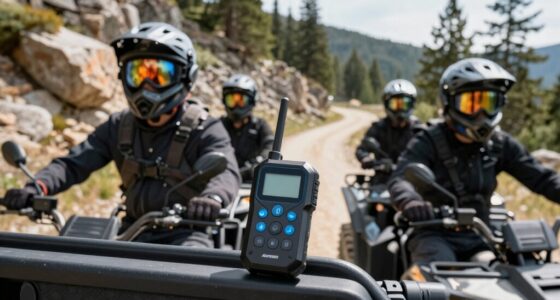
When selecting an off road GPS with topographic maps, durability and detailed mapping are key considerations. The Garmin Tread XL Overland stands out as the best overall choice thanks to its large 10-inch display and comprehensive built-in maps. For those seeking a rugged handheld, the Garmin Montana 700 offers excellent portability with routable topo maps. Meanwhile, the Garmin Tread SxS is ideal for side-by-sides and UTVs, thanks to its bright display and inReach technology. However, tradeoffs include price, complexity, and ruggedness levels. Keep reading for a full breakdown of these options and how to find the perfect fit for your off-road adventures.

Get business pricing on garage and car supplies
- Business-only prices and quantity discounts
- Tax-exempt purchasing
- Multiple users, one account, clear invoices
Complete the kit


Key Takeaways
- Top picks are distinguished by their rugged build, detailed topographic maps, and specialized features for different off-road vehicles.
- The largest screens, like the Garmin Tread XL, improve visibility but may be less portable for handheld use.
- Rugged handhelds like the Garmin Montana series excel in portability and precision but often lack larger display sizes.
- Features like inReach satellite communication and routable maps significantly enhance safety and navigation accuracy.
- Price varies considerably, with premium models offering advanced features at a higher cost, while more affordable options focus on core navigation functions.
| Garmin Tread XL Overland All-Terrain Navigator, Rugged 10″ Display, Built-in Mapping, iOverlander, Waterproof |  | Best Overall Off-Road GPS with Topographic Maps | Display: 10-inch ultrabright | Water Resistance: IP67 | Maps: Preloaded topographic, USFS, City Navigator, iOverlander POIs | VIEW ON AMAZON | See Our Full Breakdown |
| Garmin Montana 700 Rugged GPS Handheld with 5″ Touchscreen and Routable Maps |  | Best Rugged Handheld with Versatile Mapping and Long Battery Life | Screen Size: 5 inches | Display Resolution: 480 x 800 | Connectivity: Bluetooth, ANT+, Wi-Fi | VIEW ON AMAZON | See Our Full Breakdown |
| Garmin Tread SxS GPS Navigator with Ultrabright Display and inReach Technology (Renewed) |  | Best for Powersports with Satellite Connectivity and Topo Maps | Display: 8-inch ultrabright | Water Resistance: IP67 | Maps: Preloaded topographic, USFS Motor Vehicle Use Maps | VIEW ON AMAZON | See Our Full Breakdown |
| Garmin Montana 710 GPS Handheld Navigator |  | Best for Long-Duration Remote Expeditions | Display: 5-inch color touchscreen | Memory: 32 GB | Battery Life: Up to 24 hours | VIEW ON AMAZON | See Our Full Breakdown |
| Garmin Tread® 2 – SxS Edition, Rugged 8″ All-Terrain Navigator |  | Best for Off-Road and Group Exploration with Satellite Maps | Display: 8-inch high-resolution | Water Resistance: IP67 | Maps: OpenStreetMap, USFS, Adventure Roads | VIEW ON AMAZON | See Our Full Breakdown |
| Garmin Tread 2 Powersport Navigator, 6″ Glove-Friendly Display |  | Best Rugged Off-Road GPS with Advanced Sensors | Display Size: 6 inches | Water Rating: IP67 | Connectivity: Wi-Fi, Bluetooth | VIEW ON AMAZON | See Our Full Breakdown |
| Garmin GPSMAP 65s Handheld GPS with Altimeter and Compass |  | Best Handheld GPS with Multi-Band Satellite Support | Display: 2.6-inch color display | Satellite Support: Expanded GNSS and multi-band | Maps: TopoActive and federal public land | VIEW ON AMAZON | See Our Full Breakdown |
| Garmin Rino 750 Rugged Handheld 2-Way Radio GPS Navigator |  | Best for Communication and GPS in Coordinated Off-Road Missions | Screen Size: 3 inches | Additional Features: Two-way radio, high-sensitivity GPS | Battery Life: 14-18 hours | VIEW ON AMAZON | See Our Full Breakdown |
| Garmin Tread® 2 – Overland Edition Rugged All-Terrain Navigator |  | Best Large Screen Overland GPS with Topo and Satellite Imagery | Display Size: 8 inches | Water Resistance: IP67 | Maps Included: Topographic North & South America, City Navigator | VIEW ON AMAZON | See Our Full Breakdown |
| Garmin GPSMAP 66st Rugged Multisatellite Handheld with Sensors and Topo Maps |  | Best Multi-GNSS Handheld for US & Canadian Topo Adventures | Display Size: 3 inches | Supported Satellite Navigation System: Multiple GNSS | Maps: Topographic US and Canada | VIEW ON AMAZON | See Our Full Breakdown |
| Garmin Rino 750t Two-Way Radio with Topo Mapping |  | Best Overall for Dual Communication and Navigation | Compatible with Vehicle Type: Boat, Car, RV, SUV, Truck | Screen Size: 3 inches | Additional Features: Bluetooth Connectivity | VIEW ON AMAZON | See Our Full Breakdown |
| Garmin Tread Powersport Off-Road Navigator, 5.5″ Display |  | Best for Rugged Off-Road Navigation with Satellite Imagery | Display: 5.5 inches | Water Resistance: IPX7 | Preloaded Maps: Topographic of North and Central America, street maps | VIEW ON AMAZON | See Our Full Breakdown |
| off road gps with topographic map | Water Resistance | Connectivity | Display | Maps |
|---|---|---|---|---|
| Garmin Tread XL Overland All-T | IP67 | Built-in inReach satellite communication | 10-inch ultrabright | Preloaded topographic, USFS, City Navigator, iOverlander POIs |
| Garmin Montana 700 Rugged GPS | IPX7 | Bluetooth, ANT+, Wi-Fi | — | — |
| Garmin Tread SxS GPS Navigator | IP67 | inReach satellite communication | 8-inch ultrabright | Preloaded topographic, USFS Motor Vehicle Use Maps |
| Garmin Montana 710 GPS Handhel | IPX7 | — | 5-inch color touchscreen | TopoActive, optional City Navigator |
| Garmin Tread® 2 | IP67 | — | 8-inch high-resolution | OpenStreetMap, USFS, Adventure Roads |
| Garmin Tread 2 Powersport Navi | — | Wi-Fi, Bluetooth | — | — |
| Garmin GPSMAP 65s Handheld GPS | — | Garmin Explore app compatible | 2.6-inch color display | TopoActive and federal public land |
| Garmin Rino 750 Rugged Handhel | — | Bluetooth | — | — |
| Garmin Tread® 2 | IP67 | Wi-Fi, Bluetooth | — | — |
| Garmin GPSMAP 66st Rugged Mult | — | — | — | Topographic US and Canada |
| Garmin Rino 750t Two-Way Radio | — | — | — | — |
| Garmin Tread Powersport Off-Ro | IPX7 | — | 5.5 inches | — |
More Details on Our Top Picks
Garmin Tread XL Overland All-Terrain Navigator, Rugged 10″ Display, Built-in Mapping, iOverlander, Waterproof
The Garmin Tread XL Overland stands out for its large, ultrabright 10-inch display, making it ideal for viewing detailed topographic maps in rugged environments. Compared with the smaller Garmin Montana 700, its bigger screen enhances visibility and ease of use in challenging conditions, though it comes with a higher price tag and requires a subscription for inReach satellite features. Its preloaded maps cover topographic, USFS, and POIs, providing comprehensive navigation options, while the built-in satellite communication offers global connectivity—a key advantage over simpler handheld units. The device’s rugged, weather-resistant design ensures durability, perfect for serious overlanders. The main tradeoff is the reliance on subscriptions for satellite services, which can add ongoing costs. This pick suits serious off-road enthusiasts needing a durable, all-in-one device for extended trips and group rides, but may be overkill for casual users.
Pros:- Massive, bright display for easy map viewing
- Preloaded topographic and POI maps for detailed navigation
- Built-in inReach satellite communication for global connectivity
- Rugged, weatherproof design withstands tough conditions
Cons:- Requires ongoing subscription for satellite communication features
- Pre-owned models may have limited warranty or condition
Best for: Overlanders and off-road travelers who need a large display, comprehensive mapping, and satellite communication.
Not ideal for: Casual hikers or bikers seeking a lightweight, budget-friendly GPS without satellite features.
- Display:10-inch ultrabright
- Water Resistance:IP67
- Maps:Preloaded topographic, USFS, City Navigator, iOverlander POIs
- Connectivity:Built-in inReach satellite communication
- Additional features:Built-in altimeter, barometer, compass, pitch and roll gauges
Our verdict“This device is best suited for serious overlanders needing a rugged, feature-rich GPS with topographic maps and satellite connectivity.”
Garmin Montana 700 Rugged GPS Handheld with 5″ Touchscreen and Routable Maps
The Garmin Montana 700 offers a compact yet durable design with a 5-inch glove-friendly touchscreen, making it a versatile choice for outdoor explorers. Its support for multiple satellite systems and preloaded TopoActive maps make it a strong alternative to the larger Garmin Tread XL, especially for those who prioritize portability without sacrificing detailed mapping. Compared with the Tread XL, its smaller size makes it easier to carry and handle but reduces the screen real estate, which can be a drawback when viewing complex topography. The Montana 700 supports wireless sharing and imagery downloads, ideal for multi-activity use, though its higher price and complex features may require a learning curve. Its long battery life—up to 24 hours—outperforms many handhelds, making it suitable for extended trips. This device is well-suited for hikers, bikers, and hunters who need ruggedness and detailed maps in a smaller package.
Pros:- Rugged, MIL-STD 810 shock and water resistant
- Glove-friendly 5-inch touchscreen for easy operation
- Supports multiple satellite systems for accurate positioning
- Extended battery life suitable for long expeditions
Cons:- Higher price point may deter casual users
- Complex features could require a steep learning curve
Best for: Hikers and outdoor enthusiasts who value portability, durability, and detailed topographic mapping.
Not ideal for: Casual users or those seeking a larger display for in-vehicle navigation or group rides.
- Screen Size:5 inches
- Display Resolution:480 x 800
- Connectivity:Bluetooth, ANT+, Wi-Fi
- Battery Life:Up to 24 hours
- Water Resistance:IPX7
- Construction:MIL-STD 810
Our verdict“This model is ideal for serious outdoor users who need durable, portable mapping with long battery life and multi-GNSS support.”
Garmin Tread SxS GPS Navigator with Ultrabright Display and inReach Technology (Renewed)
The Garmin Tread SxS excels for motorsports enthusiasts needing a rugged, high-brightness 8-inch touchscreen with topographic maps and satellite communication. Its preloaded North and Central American topographic maps, along with USFS Motor Vehicle Use Maps, make it especially useful for off-road adventures in challenging terrains. Compared with the Garmin Tread XL, its smaller 8-inch screen offers a more manageable size for mounting on vehicles or ATVs but slightly reduces map viewing area. The built-in inReach technology ensures global connectivity, a significant advantage for remote areas. Its weather-resistant design supports group ride tracking and navigation, though a subscription is necessary for satellite features, and some map data might not be as detailed in certain regions. This pick is perfect for powersports riders who want a compact yet feature-rich navigation device with satellite communication.
Pros:- Bright, easy-to-read 8-inch display
- Preloaded topographic and motor vehicle maps
- Built-in inReach satellite communication for global coverage
- Supports group ride and trail navigation features
Cons:- Requires subscription for inReach satellite services
- Limited map detail in some areas may affect route accuracy
Best for: Motorsports, ATV, and dirt bike riders who need a rugged device with topographic maps and satellite communication.
Not ideal for: Casual hikers or bikers who don’t require satellite connectivity and prefer simpler handheld units.
- Display:8-inch ultrabright
- Water Resistance:IP67
- Maps:Preloaded topographic, USFS Motor Vehicle Use Maps
- Connectivity:inReach satellite communication
- Features:Group Ride Radio, altimeter, barometer, compass
Our verdict“This device is ideal for powersports riders needing a rugged, satellite-connected GPS with topographic maps in a manageable size.”
Garmin Montana 710 GPS Handheld Navigator
The Garmin Montana 710 is a rugged, high-capacity handheld designed for serious outdoor expeditions. Its 32 GB expandable storage, combined with a 5-inch glove-friendly display, offers a balance of portability and detailed mapping, including TopoActive and optional City Navigator. Its long battery life—up to 24 hours—makes it suitable for extended trips, and its MIL-STD 810 and IPX7 ratings ensure durability in tough conditions. When compared to the Montana 700, the 710’s increased storage capacity allows for more maps and imagery, but its smaller screen offers less real estate for map viewing. Its support for multiple sensors and Wi-Fi connectivity adds versatility, though some features depend on additional purchases or subscriptions. This device is best for explorers who need a rugged, reliable navigator with broad storage for extensive mapping and imagery.
Pros:- Rugged, water and shock resistant construction
- Large 32 GB storage for maps and imagery
- Glove-friendly 5-inch touchscreen
- Long battery life for extended expeditions
Cons:- Additional mapping may require separate purchases
- Some features depend on Wi-Fi or subscriptions
Best for: Backcountry explorers and long-term adventurers who need durable, high-capacity mapping on a portable device.
Not ideal for: Urban users or casual hikers who prioritize a larger display for quick, casual navigation.
- Display:5-inch color touchscreen
- Memory:32 GB
- Battery Life:Up to 24 hours
- Water Resistance:IPX7
- Shock Resistance:MIL-STD 810
- Maps:TopoActive, optional City Navigator
Our verdict“This handheld is best for serious outdoor users needing durable, high-storage mapping on extended trips in remote locations.”
Garmin Tread® 2 – SxS Edition, Rugged 8″ All-Terrain Navigator
The Garmin Tread® 2 SxS Edition is crafted for extreme off-road use, offering an 8-inch high-resolution touchscreen with detailed topographic maps and satellite imagery. Its extensive trail data, including USFS and Adventure Roads, makes it ideal for dirt biking, ATV riding, and group exploration. Compared with the Tread XL, its slightly smaller 8-inch display offers easier mounting and handling on vehicles, while still delivering comprehensive mapping features. The device supports live tracking, campgrounds, snow trails, and satellite imagery, making it suitable for tackling challenging terrains. However, accessing some premium map content requires a subscription, and map data can be limited in some regions, which might affect trail recommendations. This device is best for off-road adventurers who need ruggedness, detailed maps, and real-time tracking in extreme environments.
Pros:- High-resolution 8-inch display for clear map viewing
- Supports satellite imagery and detailed trail data
- Designed for extreme weather and tough conditions
- Supports live tracking and group ride features
Cons:- Subscription needed for some premium map content
- Limited map detail in certain regions may affect trail accuracy
Best for: Dirt bike, ATV riders, and off-road groups seeking a rugged, feature-rich GPS with satellite imagery and trail info.
Not ideal for: Casual outdoor users or those preferring larger screens for general hiking or urban navigation.
- Display:8-inch high-resolution
- Water Resistance:IP67
- Maps:OpenStreetMap, USFS, Adventure Roads
- Features:Satellite imagery, group tracking, elevation data
- Includes:Tube mount, power cable
Our verdict“This navigator is best for off-road explorers who need a rugged device with detailed topographic maps, satellite imagery, and real-time tracking capabilities.”
Garmin Tread 2 Powersport Navigator, 6″ Glove-Friendly Display
The Garmin Tread 2 shines for its durability and comprehensive outdoor features. Its rugged, weather-resistant design paired with a high-resolution, glove-friendly touchscreen makes it ideal for extreme conditions. Unlike the Garmin GPSMAP 65s, it offers more trail-specific tools like satellite imagery, private/public land info, and group ride tracking, making it a top choice for off-road enthusiasts who need more than basic navigation. The main tradeoff is the subscription fee for premium maps, which can add to ongoing costs. Additionally, its setup process might challenge beginners unfamiliar with advanced GPS devices.
Best suited for serious off-road users and outdoor adventurers who prioritize durability and trail-specific features.
Not ideal for casual hikers or users seeking a budget-friendly, simple navigation device.
- Rugged and weather-resistant design suitable for extreme conditions
- High-resolution, glove-friendly touchscreen display
- Includes detailed outdoor maps, satellite imagery, and land info
- Subscription required for premium map features
- Complex setup may overwhelm beginners
Verdict: This GPS is perfect for experienced outdoor users needing robust features in challenging environments.
Pros:- Rugged and weather-resistant design suitable for extreme conditions
- High-resolution, glove-friendly touchscreen display
- Comprehensive outdoor maps including satellite imagery
Cons:- Subscription required for premium map features
- Complex setup process may be difficult for beginners
Best for: Off-road riders and outdoor adventurers who need durability and trail-specific data
Not ideal for: Casual hikers or those on a tight budget seeking simple navigation
- Display Size:6 inches
- Water Rating:IP67
- Connectivity:Wi-Fi, Bluetooth
- Maps Included:OpenStreetMap, U.S. Forest Service, Adventure Roads, City Navigator
- Additional Features:Digital elevation maps, private/public land info, campgrounds, snow trails, satellite imagery, group ride tracking
- Sensors:Altimeter, barometer, compass, pitch/roll gauges
Our verdict“This device is best for experienced off-road users demanding high durability and advanced features.”
Garmin GPSMAP 65s Handheld GPS with Altimeter and Compass
The Garmin GPSMAP 65s offers a compact, sunlight-readable display with advanced satellite support, making it ideal for navigating in challenging environments. Its multi-band GNSS support and 3-axis compass with barometric altimeter deliver reliable positioning where coverage might be spotty, compared to the larger Tread 2. However, it lacks the trail-specific features and detailed topographic maps found on the Garmin Tread 2 or Tread® 2 Overland Edition, limiting its usefulness for complex off-road routes. Its smaller screen and somewhat complex interface could also pose challenges for casual users. Nonetheless, for those valuing precise positioning over extensive mapping, this device provides solid core navigation tools.
Best suited for backcountry explorers who need reliable GPS in remote areas and are comfortable with a learning curve.
Not ideal for beginners or users seeking detailed trail maps and navigation features.
- Sunlight-readable, 2.6-inch color display
- Supports multiple satellite systems for better accuracy
- Includes detailed topo maps and a 3-axis compass
- Requires a compatible smartphone for full app features
- May be complex for casual users unfamiliar with advanced GPS
Verdict: This device is a smart choice for serious outdoor enthusiasts needing dependable GPS positioning in remote areas.
Pros:- Sunlight-readable, 2.6-inch color display
- Supports multiple satellite systems for reliable tracking
- Includes detailed TopoActive maps and a 3-axis compass
Cons:- Requires a compatible smartphone for full functionality
- Smaller screen may be less intuitive for some users
Best for: Backcountry hikers and hunters who rely on multi-band satellite support
Not ideal for: Casual hikers looking for simple, straightforward maps and navigation
- Display:2.6-inch color display
- Satellite Support:Expanded GNSS and multi-band
- Maps:TopoActive and federal public land
- Features:3-axis compass, barometric altimeter
- Connectivity:Garmin Explore app compatible
Our verdict“Ideal for advanced outdoor users who prioritize precise, multi-satellite navigation over extensive mapping features.”
Garmin Rino 750 Rugged Handheld 2-Way Radio GPS Navigator
The Garmin Rino 750 combines robust GPS navigation with two-way radio communication, making it a standout for group outdoor activities. Its high-sensitivity GPS and rugged build support navigation in tough terrain, while the 3-inch sunlight-readable touchscreen enhances usability. Unlike the Garmin Tread 2, which focuses solely on navigation, the Rino 750 emphasizes communication, making it ideal for coordinated adventures or rescue missions. Its long battery life and extended communication range up to 20 miles set it apart, but it’s less suited for users who need detailed topographic maps or advanced trail features. Some features, like software updates, are less transparent, which could be a concern for long-term use.
Best suited for outdoor groups and search-and-rescue teams needing reliable navigation and communication.
Not ideal for solo adventurers or those primarily seeking detailed trail mapping.
- Extended communication range up to 20 miles
- High-sensitivity GPS for difficult environments
- Rugged, durable design with long battery life
- Limited info on software updates or map customization
- Features may require additional compatible devices
Verdict: This GPS is ideal for groups needing reliable location sharing and rugged navigation in challenging outdoor scenarios.
Pros:- Extended communication range up to 20 miles
- High-sensitivity GPS for tough environments
- Rugged, durable design with long battery life
Cons:- Limited information on ongoing software updates
- Less suited for those primarily seeking detailed maps
Best for: Outdoor groups, search-and-rescue teams, and coordinated adventure groups
Not ideal for: Solo hikers or casual users seeking detailed topographic maps without communication features
- Screen Size:3 inches
- Additional Features:Two-way radio, high-sensitivity GPS
- Battery Life:14-18 hours
- Connectivity:Bluetooth
- Resolution:240 x 400
- Mounting Type:Wrist Mount
Our verdict“Perfect for outdoor teams who need dependable GPS plus reliable two-way radio communication.”
Garmin Tread® 2 – Overland Edition Rugged All-Terrain Navigator
The Garmin Tread® 2 Overland Edition offers an expansive 8-inch screen that excels for overland expeditions. Its high-resolution display remains usable with gloves, and it comes preloaded with topographic maps of North and South America, along with City Navigator data. Compared to the Garmin Tread 2 Powersport Navigator, this model is tailored for longer overland trips where map detail and screen size matter most. It supports downloadable satellite imagery and premium map content via subscription, adding versatility but also ongoing costs. The device’s heavy-duty mounting options make it suitable for vehicle use, although the size might be less portable for smaller off-road outings. Its map data limitations can sometimes hinder specific route planning if updates are not current.
Best suited for overland explorers and vehicle-based adventurers needing a large, detailed navigation display.
Not ideal for users seeking a lightweight, handheld device or those who prefer free satellite imagery without subscriptions.
- Large 8-inch, glove-friendly touchscreen
- Preloaded topographic maps for North and South America
- Supports satellite imagery and subscription maps
- Map data may be outdated or limited for some routes
- Requires Wi-Fi for downloading satellite imagery
Verdict: This model is best for overland travelers needing a sizable, detailed navigation system with map flexibility.
Pros:- Large 8-inch, glove-friendly touchscreen
- Preloaded topographic maps of entire Americas
- Supports downloadable satellite imagery and premium maps
Cons:- Map data may require updates, sometimes limiting accuracy
- Subscription fees for premium map content
Best for: Overland vehicle explorers and long-range off-road travelers
Not ideal for: Lightweight hikers or those on a tight budget seeking basic maps
- Display Size:8 inches
- Water Resistance:IP67
- Maps Included:Topographic North & South America, City Navigator
- Satellite Imagery:Downloadable, subscription-based
- Connectivity:Wi-Fi, Bluetooth
- Mounting:Heavy-duty suction cup, magnet-assisted lock
Our verdict“Ideal for overland drivers and vehicle-based explorers who need a large, detailed screen with map flexibility.”
Garmin GPSMAP 66st Rugged Multisatellite Handheld with Sensors and Topo Maps
The Garmin GPSMAP 66st combines durability with multi-GNSS support, making it highly reliable for US and Canadian outdoor activities. Its 3-inch sunlight-readable display ensures visibility in bright conditions, and preloaded topographic maps simplify route planning. Compared with the Garmin GPSMAP 65s, it offers longer battery life and broader satellite compatibility, enhancing performance in remote areas. Still, its interface can be complex for casual users, and some features may require additional subscriptions or downloads. This device suits users who prioritize multi-system tracking and detailed topo maps over a larger screen or advanced trail features.
Best suited for backcountry explorers and outdoor enthusiasts focused on precise navigation in North America.
Not ideal for beginners or casual hikers who prefer straightforward interfaces and fewer subscription requirements.
- Rugged, durable design for outdoor use
- Supports multiple satellite systems for reliable tracking
- Preloaded topographic maps of US and Canada
- Complex interface may require learning curve
- Price may be high without clear value for casual users
Verdict: This device is well-suited for detailed, multi-satellite navigation in North American wilderness.
Pros:- Rugged and durable for outdoor conditions
- Supports multiple satellite systems for accurate positioning
- Preloaded with detailed topographic maps of US and Canada
Cons:- Complex interface requiring a learning curve
- Potentially expensive for casual users
Best for: Advanced hikers, hunters, and outdoor enthusiasts in North America
Not ideal for: Users seeking an easy-to-use device with minimal setup and no subscription fees
- Display Size:3 inches
- Supported Satellite Navigation System:Multiple GNSS
- Maps:Topographic US and Canada
- Battery Life:16 hours
- Connectivity Protocol:Bluetooth
- Additional Features:Sensors, wireless updates
Our verdict“This GPS is best for those needing multi-satellite support and detailed topo maps for North American adventures.”
Garmin Rino 750t Two-Way Radio with Topo Mapping
The Garmin Rino 750t stands out for combining a powerful 5-watt GMRS two-way radio with detailed US Topo maps, making it ideal for both communication and navigation in rugged outdoor environments. Compared with the Garmin Tread Powersport Navigator, it offers longer-range radio communication, which is essential in remote areas where satellite connectivity might be unreliable. While its preloaded maps and multi-GNSS support provide reliable positioning, the Rino 750t’s weather forecast feature isn’t available everywhere, and its battery life can vary with heavy use. The device’s 3-inch touchscreen is clear, but it requires separate batteries for extended trips. This makes it a versatile choice for outdoor enthusiasts who value reliable communication alongside detailed topographic maps.
Pros:- Long-range communication up to 20 miles for effective team coordination
- Preloaded with detailed US Topo maps for accurate navigation
- Supports multi-GNSS for consistent positioning in challenging environments
- Bluetooth connectivity for hands-free headset use
Cons:- Weather forecast feature not available in all regions, limiting its weather tracking usefulness
- Battery life can fluctuate depending on usage and may require extra batteries for extended trips
Best for: Off-roaders and outdoor adventurers needing reliable radio communication combined with detailed US Topo mapping.
Not ideal for: Casual hikers or travelers who don’t require long-range radio capabilities or rugged durability.
- Compatible with Vehicle Type:Boat, Car, RV, SUV, Truck
- Screen Size:3 inches
- Additional Features:Bluetooth Connectivity
- Map Types:North America
- Audio Output Mode:Stereo
- Battery Average Life:18 hours
Our verdict“This device suits serious outdoor users who need both dependable communication and topographic mapping in rugged terrain.”
Garmin Tread Powersport Off-Road Navigator, 5.5″ Display
The Garmin Tread Powersport Navigator excels in extreme terrains thanks to its rugged, weather-resistant design and large 5.5-inch display, which offers clear visibility even in bright sunlight. Unlike the Garmin Rino 750t, it supports downloadable BirdsEye Satellite Imagery, providing visual context that’s invaluable when traversing complex off-road landscapes. It preloads detailed topographic maps and land boundaries, including U.S. Forest Service roads and trails, making it perfect for off-road adventures where detailed land info matters most. However, it requires a separate satellite communicator for global communication, adding extra cost and complexity. Its setup can be challenging for casual users unfamiliar with advanced GPS devices. This pick is best suited for serious off-road enthusiasts who want detailed maps and satellite imagery in a tough, weatherproof package.
Pros:- Rugged and weather-resistant IPX7 design suitable for extreme terrains
- Preloaded with detailed topographic maps and satellite imagery for comprehensive navigation
- Includes land boundaries and forest service roads for precise off-road planning
- Large 5.5-inch display provides excellent visibility in challenging conditions
Cons:- Requires an additional satellite communicator for global communication, increasing overall cost
- Complex setup and feature set may be overwhelming for casual users or beginners
Best for: Off-road riders and explorers needing detailed topo maps, satellite imagery, and a rugged build for extreme environments.
Not ideal for: Casual trail users or those seeking a simple navigation device without the need for satellite communication or extra accessories.
- Display:5.5 inches
- Water Resistance:IPX7
- Preloaded Maps:Topographic of North and Central America, street maps
- Land Boundaries:U.S. public and private land boundaries
- Roads and Trails:U.S. Forest Service roads and trails with M.U.V. maps
- Satellite Imagery:Downloadable BirdsEye Satellite Imagery
Our verdict“This device is ideal for dedicated off-road explorers who need detailed maps, satellite imagery, and a tough build for extreme environments.”
How We Picked
Each device was evaluated based on its durability, accuracy of topographic mapping, ease of use in rugged conditions, battery life, and additional features such as satellite communication or vehicle integration. We prioritized products that combine reliable mapping with rugged build quality suitable for off-road environments. The ranking reflects a balance between performance, versatility, and value, considering how well each device serves different types of off-road enthusiasts—from casual riders to serious overlanders. Devices that excelled in core navigation and durability, while offering thoughtful extras, earned higher placement.| off road gps with topographic map | Water Resistance | Maps | Connectivity |
|---|---|---|---|
| Garmin Tread XL Overland All-T | IP67 | Preloaded topographic, USFS, City Navigator, iOverlander POIs | Built-in inReach satellite communication |
| Garmin Montana 700 Rugged GPS | IPX7 | — | Bluetooth, ANT+, Wi-Fi |
| Garmin Tread SxS GPS Navigator | IP67 | Preloaded topographic, USFS Motor Vehicle Use Maps | inReach satellite communication |
| Garmin Montana 710 GPS Handhel | IPX7 | TopoActive, optional City Navigator | — |
| Garmin Tread® 2 | IP67 | OpenStreetMap, USFS, Adventure Roads | — |
| Garmin Tread 2 Powersport Navi | — | — | Wi-Fi, Bluetooth |
| Garmin GPSMAP 65s Handheld GPS | — | TopoActive and federal public land | Garmin Explore app compatible |
| Garmin Rino 750 Rugged Handhel | — | — | Bluetooth |
| Garmin Tread® 2 | IP67 | — | Wi-Fi, Bluetooth |
| Garmin GPSMAP 66st Rugged Mult | — | Topographic US and Canada | — |
| Garmin Rino 750t Two-Way Radio | — | — | — |
| Garmin Tread Powersport Off-Ro | IPX7 | — | — |
Factors to Consider When Choosing Off Road Gps With Topographic Maps
Choosing the right off road GPS with topographic maps requires understanding several key factors. While some units prioritize rugged design and extensive maps, others focus on portability or communication features. Being clear about your main use case—whether trail riding, overlanding, or side-by-side adventures—will help narrow your options. Consider how intuitive the device is in challenging conditions and what additional features, like satellite messaging or route planning, are necessary for your safety and convenience. Price and battery life are also important, especially for longer trips. This guide outlines the critical elements to consider before making your purchase.Durability and Ruggedness
When venturing into off-road terrain, your GPS needs to withstand shocks, water, and dirt. Look for units with MIL-STD-810 or IP ratings, which indicate toughness. Some devices, like the Garmin Tread XL and Montana series, are specifically engineered for harsh conditions, making them ideal for demanding environments. However, increased ruggedness often adds weight and size, which can impact portability. Choosing a device that balances durability with ease of handling will ensure your navigation remains reliable without becoming cumbersome.
Topographic Map Detail and Coverage
High-quality topographic maps are the core feature of these devices. Consider whether the maps are routable—meaning you can follow trails and routes directly—or just for reference. Some units come with preloaded maps, while others allow you to load additional regional or worldwide topo maps. More detailed maps improve navigation accuracy but may increase device cost or storage requirements. Think about the size of your typical exploration area and choose a device that offers comprehensive coverage without overwhelming your storage capacity.
Display Size and Readability
Display size impacts how easily you can view maps and data in bright sunlight or from a distance. Larger screens like the 10-inch Garmin Tread XL provide excellent visibility but may be less portable for handheld use. Smaller screens are more convenient for quick reference but can be harder to read in rugged conditions. Glove-friendly touchscreens are a bonus for quick interactions, especially when wearing gloves or in cold weather. Balance display size with device portability based on your typical adventure style.
Battery Life and Power Options
Extended trips demand long-lasting power sources. Look for units with impressive battery life—some Garmin models offer 16 hours or more—and consider options for external power or portable batteries. Devices with solar charging capabilities or low-power modes can extend usage time in remote areas. Keep in mind that high-brightness screens and advanced features consume more power, so choose a device with a battery life aligned with your trip duration and planned recharging opportunities.
Additional Features and Connectivity
Extra features can significantly enhance your off-road experience. Satellite communication via inReach technology adds safety by enabling SOS and two-way messaging in remote zones. Route planning and breadcrumb tracking help you retrace your steps. Some devices support Bluetooth or Wi-Fi for map updates and data sharing. Be mindful that added features often increase cost and complexity; prioritize what aligns with your safety needs and adventure style.
Frequently Asked Questions
Can I use topographic maps offline with these GPS units?
Yes, most off-road GPS devices with topographic maps are designed for offline use, which is essential for remote adventures where cellular signals are unavailable. Many units come with preloaded maps or allow you to load additional topographic data before heading out. Ensuring your device has sufficient storage space for these maps is important, especially if you plan to explore multiple regions. Offline capability guarantees you can rely on your navigation even in the most isolated areas.
How accurate are the topographic maps on these GPS units?
The accuracy of topographic maps varies depending on the source and update frequency. Devices like Garmin’s premium models use detailed USGS or other reliable map sources, providing high-precision terrain data. Routable maps allow you to follow trails with confidence, but some maps may have outdated or incomplete data in less-mapped regions. Always check the map source and update options, and consider supplementing with external map files for the most current information.
Are these GPS devices water-resistant or waterproof?
Most rugged off-road GPS units, such as those from Garmin, are built with water resistance or waterproof ratings—commonly IPX7 or IPX8—meaning they can withstand rain, splashes, and immersion in shallow water. This durability is vital when operating in muddy, wet, or snowy environments. Always verify the specific rating for your chosen model, and use protective cases if you plan to expose the device to extreme conditions frequently.
Do I need a separate device for communication or can these GPS units do it all?
While some GPS units incorporate communication features like inReach satellite messaging or two-way radios, many focus solely on navigation. If safety and communication are priorities, selecting a device with built-in satellite messaging can be invaluable, especially in remote areas. However, these features generally come at a higher cost and may require subscription plans. For simpler navigation, a dedicated GPS with excellent maps may suffice, but combining it with a separate satellite communicator can enhance safety.
How important is screen size versus portability in off-road GPS units?
Screen size greatly impacts visibility, especially in bright sunlight or when wearing gloves. Larger screens like the Garmin Tread XL improve map readability but tend to be bulkier and less portable. Smaller handhelds like the Montana series are more portable and easier to carry but might sacrifice some clarity and ease of use in rugged conditions. Consider how you’ll use the device—if mounted in a vehicle or ATV, a larger screen makes sense; for handheld use, smaller, more portable units could be preferable.
Conclusion
For those who prioritize comprehensive, reliable navigation in challenging environments, the Garmin Tread XL Overland stands out as the best overall pick due to its large display and extensive mapping features. If portability and ruggedness are your main concerns, the Garmin Montana 700 offers a balanced mix of size and detailed topo maps at a more accessible price. Serious off-roaders or overlanders seeking premium features and safety tools should consider the Garmin Tread SxS or Tread 2 models. Beginners or casual explorers might find the GPSMAP 66st enough for their needs without the complexity of advanced features. Ultimately, your choice depends on your specific off-road activities, budget, and how much you value features like communication or display size.
As an affiliate, we earn on qualifying purchases.Fall Picks
fall essentials