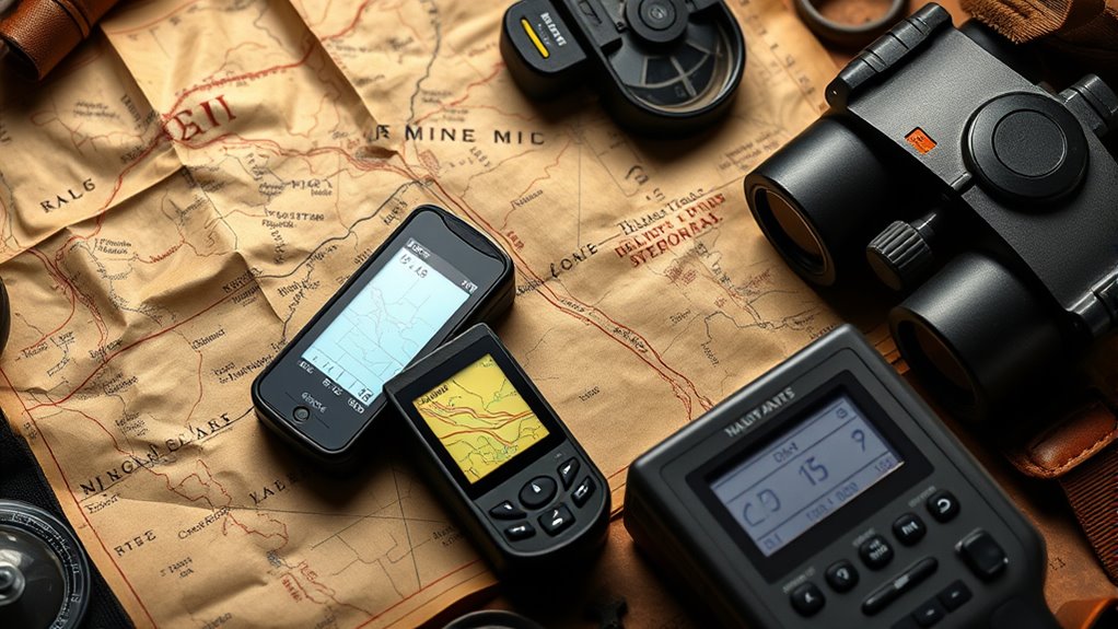

The evolution of rally raid navigation equipment has transformed from simple paper maps, compasses, and written notes to advanced digital systems. You’ve moved from relying on basic tools to using GPS, real-time telemetry, and digital mapping that provide precise location tracking and instant updates. These innovations make navigation safer, faster, and more accurate. If you want to explore how these technologies continue to advance, there’s more to discover below.
Key Takeaways
- Transition from paper maps and compasses to mechanical and optical devices improved basic navigation accuracy.
- Integration of digital tools and electronic instruments enabled real-time data and automated route management.
- GPS technology revolutionized rally raid navigation with precise tracking and live location updates.
- Advanced software and satellite imagery enhanced terrain understanding and strategic planning.
- Future innovations like AI-driven autonomous systems aim to improve safety, decision-making, and route adaptability.
Early Navigation Methods and Their Limitations
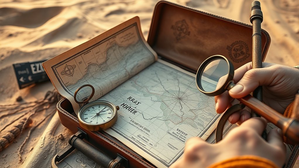
Before modern navigation tools, rally raid competitors relied heavily on basic methods like paper maps, compasses, and written notes, which often proved unreliable in the challenging terrains they faced. You had to interpret crude maps while steering through unpredictable landscapes, risking getting lost or wasting time. Compasses helped with direction but offered no help with distance or terrain obstacles. Written notes, like landmarks or instructions, depended on memory and could be misread or forgotten under stress. These methods demanded constant attention and skill, yet many competitors still faced misdirection or delays. The lack of precise tools meant route errors were common, making the race more about endurance and luck than accuracy. Such limitations highlighted the need for more reliable, advanced navigation solutions in future rally raid developments.
The Rise of Mechanical and Optical Devices
As rally raid navigation evolved, competitors increasingly turned to mechanical and optical devices to improve accuracy and reliability. Mechanical compasses became essential tools, helping you determine your direction when visual cues were limited. Optical devices like binoculars allowed you to scan distant landmarks more precisely, aiding in navigation over vast, featureless terrains. These tools reduced dependence on basic map reading and manual calculations, offering quicker, more dependable guidance. Mechanical odometers tracked distances traveled, helping you stay on course and manage waypoints effectively. The durability and simplicity of these devices made them popular in harsh environments, where electronic failures could occur. Overall, they provided a vital edge, allowing you to navigate more confidently in challenging conditions. High-quality equipment is crucial for success in demanding rally raid environments, ensuring consistent performance even in adverse conditions.
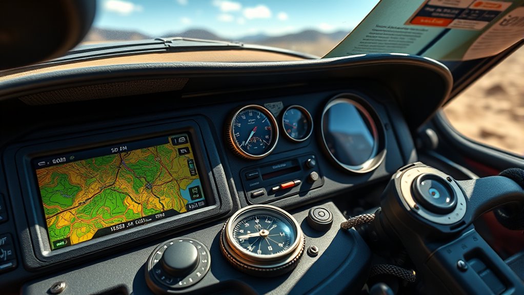
Adoption of Digital Roadbooks and Electronic Instruments
Digital roadbooks and electronic instruments boost your navigation accuracy by providing precise, up-to-date information. They also enable real-time data integration, keeping you informed of changing conditions instantly. This technology transforms how you approach rally raid navigation, making it more efficient and reliable.
Enhanced Navigation Accuracy
The adoption of digital roadbooks and electronic instruments has considerably improved navigation accuracy in rally raid events. These tools reduce human error and ensure you follow precise routes, even in challenging terrains. Digital systems provide real-time updates, making it easier to adjust your course quickly. They also minimize misinterpretations common with traditional paper notes, enhancing overall safety and efficiency. Here’s a quick comparison:
| Feature | Traditional Paper Notes | Digital Roadbooks & Instruments |
|---|---|---|
| Accuracy | Prone to human error | High precision, real-time updates |
| Ease of Use | Manual reading and interpretation | Clear display, automated alerts |
| Updates | Static, require manual revision | Instant, remote updates |
| Safety | Less reliable in complex terrains | Improved safety via alerts |
| Efficiency | Slower navigation process | Faster, more reliable navigation |
Digital tools also often incorporate advanced navigation features that further enhance route management and situational awareness during the race.
Real-Time Data Integration
Building on advances in navigation accuracy, integrating real-time data through digital roadbooks and electronic instruments transforms how rally raid competitors stay on course. You now receive live updates, ensuring you can adapt quickly to unexpected changes and obstacles. Digital roadbooks display dynamic information, reducing the risk of misreading paper notes. Electronic instruments sync with GPS data, offering precise positioning and real-time route adjustments. This integration improves safety, efficiency, and race strategy. Recognizing the importance of data accuracy is essential for making informed decisions during the race.
Key benefits include:
- Instant access to updated navigation instructions.
- Reduced human error with automated alerts.
- Enhanced situational awareness through synchronized data streams.
Adopting these technologies allows you to navigate more confidently, making split-second decisions based on current conditions while streamlining the complex process of rally raid navigation.
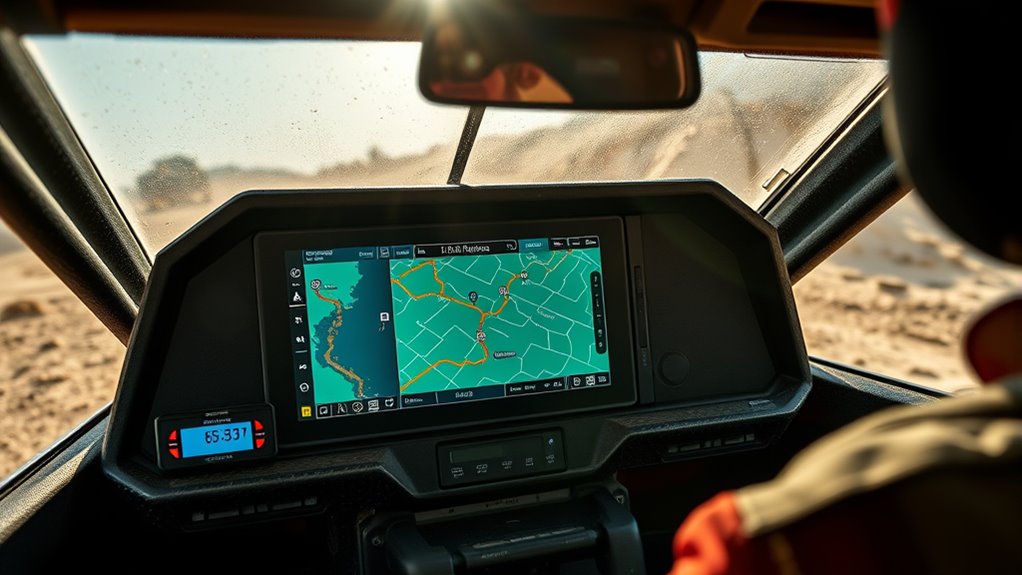
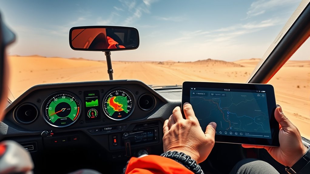
Integration of GPS Technology in Rally Raid
GPS technology has transformed rally raid navigation by providing precise route tracking, ensuring you stay on course. With real-time location updates, you can quickly respond to changes and avoid potential hazards. This integration makes navigation more accurate and reliable, enhancing overall race safety and efficiency. Moreover, leveraging local knowledge can further improve strategic decision-making during races.
Precise Route Tracking
As rally raid events have grown more complex, integrating GPS technology has become essential for precise route tracking. With GPS, you can accurately follow the course, reducing mistakes and ensuring adherence to the route. This technology allows you to verify your position at any moment and make quick adjustments if needed. To maximize its benefits, focus on:
- Waypoint Verification – Confirm you’re on the correct path by checking specific coordinates.
- Route Reconciliation – Cross-reference your GPS data with the official route to identify deviations.
- Progress Monitoring – Track your advancement along the route in real time, ensuring timely navigation decisions.
- Color Accuracy – Ensuring your GPS device displays accurate colors can improve visibility and interpretation of the route data, which is crucial for image quality and overall navigation clarity.
This precise tracking enhances safety, improves timing, and helps you stay competitive in challenging terrains. It’s a crucial tool that transforms how you navigate rally raid courses today.
Real-Time Location Updates
Real-time location updates take route tracking a step further by providing continuous, live data on your position during the race. With GPS technology, you receive instant updates, allowing you to see your exact location at any moment. This immediate feedback helps you make quick decisions, avoid obstacles, and stay on course. It also enables race organizers to monitor your progress and ensure safety. The integration of GPS enhances navigation accuracy, reducing the risk of getting lost or making wrong turns. You can compare your position against the route map in real time, adjusting your path as needed. Overall, real-time location updates improve race efficiency, safety, and strategic planning, making rally raid navigation more reliable and responsive than ever before. Incorporating lifestyle considerations such as ergonomic positioning and proper lighting can further optimize your experience and performance during the race.
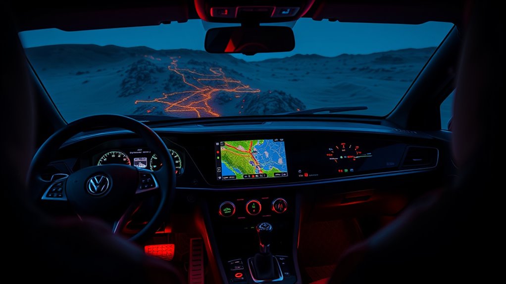
Real-Time Tracking and Telemetry Systems
Advancements in tracking and telemetry technology have revolutionized rally raid navigation by providing instant, accurate data to teams and organizers. You now receive real-time updates on vehicle positions, speeds, and statuses, enabling quick decision-making and enhanced safety. These systems transmit data via satellite or cellular networks, ensuring continuous communication even in remote areas. The technology also allows for live monitoring of vehicle performance and environmental conditions, helping teams optimize strategies. Key features include:
Real-time tracking and telemetry enhance rally raid safety, strategy, and fairness through instant vehicle data and continuous communication.
- Continuous vehicle location tracking for precise positioning
- Real-time data transmission for immediate updates
- Telemetry sensors to monitor vehicle health and environmental factors
- Reliable communication networks are essential for maintaining seamless data flow in challenging terrains.
This integration improves coordination, safety, and competition fairness, making rally raid events more efficient and spectator-friendly.
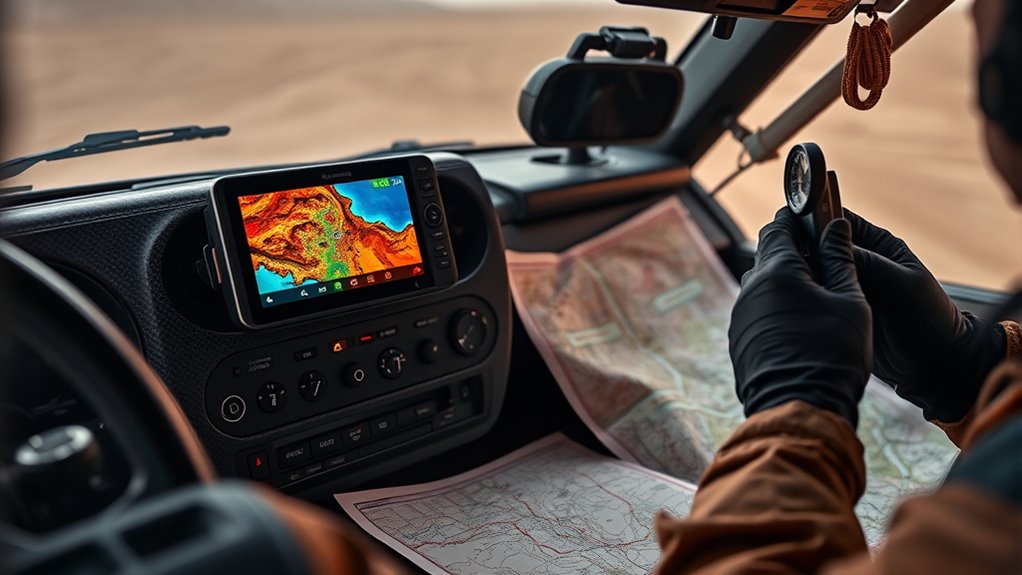
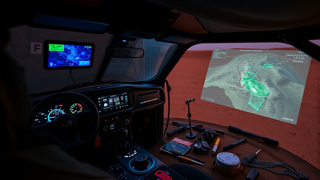
Advances in Software and Digital Mapping Solutions
Recent developments in software and digital mapping have markedly enhanced rally raid navigation by offering more accurate, detailed, and user-friendly tools. Advanced GPS applications and specialized mapping software now provide real-time updates, enabling you to better interpret terrain, track routes, and adjust on the fly. Cloud-based platforms allow seamless data sharing among team members, improving coordination and decision-making. High-resolution satellite imagery and terrain modeling give you a clearer picture of your environment, reducing errors and increasing confidence during challenging sections. You can also customize maps to highlight key waypoints, hazards, and navigation cues, streamlining your focus. These innovations make navigation more intuitive, helping you stay on course and perform at your best in demanding rally raid conditions. Implementing real-time monitoring systems further enhances your ability to respond swiftly to changing conditions, ensuring optimal performance throughout the race.
Building on the improvements in digital mapping and software, the future of rally raid navigation is shaping toward autonomous systems and AI-driven assistance. You’ll see navigation tools that can independently interpret terrain data, make real-time decisions, and adapt routes without constant human input. AI algorithms will analyze sensor data to improve accuracy and safety, reducing the chances of errors in challenging environments. Incorporating juice cleanse benefits from health trends highlights how continuous innovation can enhance operational performance and safety.
These advancements will make rally raids safer, more efficient, and accessible, pushing the boundaries of what’s possible in off-road racing.
Frequently Asked Questions
How Did Early Explorers Navigate Challenging Terrains Before Modern Tools?
Before modern tools, you relied on natural navigation methods to tackle tough terrains. You used the sun, stars, and landmarks to find your way, trusting your sense of direction and environmental cues. Maps and compasses came later, but early explorers depended heavily on their observational skills, experience, and intuition to navigate through unfamiliar, challenging landscapes, ensuring they stayed on course despite limited technology.
What Role Did Cultural and Regional Factors Influence Navigation Device Development?
You might think navigation devices are straightforward, but cultural and regional factors dramatically shaped their development. These influences determined the design, accuracy, and accessibility of tools, making navigation as unique as the landscapes themselves. In some regions, reliance on celestial cues or traditional markers persisted, while others embraced cutting-edge technology. These differences created a tapestry of navigation methods, each reflecting local history, environment, and culture—proving that navigation is as diverse as the world it explores.
How Have Environmental Changes Impacted Rally Raid Navigation Strategies?
Environmental changes have considerably impacted your rally raid navigation strategies. You now need to adapt to shifting terrains, unpredictable weather, and changing landscapes that challenge traditional routes. These factors force you to rely more on advanced GPS systems, real-time updates, and flexible planning. Staying aware of environmental conditions helps you avoid hazards, find ideal paths, and improve safety, ensuring your navigation remains effective despite the evolving natural landscape.
What Training Is Required for Drivers to Effectively Use Advanced Navigation Tech?
You might think fancy navigation tech requires no training, but think again. To use advanced rally raid navigation tools effectively, you need hands-on training that covers GPS operation, map reading, and troubleshooting. You’ll also learn how to interpret real-time data and adapt quickly in tough terrains. Without proper training, all that cutting-edge gear becomes just shiny gadgets, leaving you lost when you need them most.
How Do Legal Regulations Affect the Adoption of New Navigation Systems?
You need to understand that legal regulations can considerably influence how quickly you adopt new navigation systems. Regulations may set standards for safety, testing, and approval processes, which can slow down or restrict new technology use. You must stay informed about these rules to ensure compliance. By doing so, you can better plan upgrades and avoid penalties, ultimately enhancing your rally raid performance while adhering to legal requirements.
Conclusion
As you navigate the evolution of rally raid equipment, imagine stepping into a high-tech cockpit where every tool is a compass guiding you through uncharted terrains. From simple maps to AI-powered autopilots, technology has transformed your journey into an exhilarating adventure. Embrace these innovations, for they’re the stars lighting your path through the wilderness, turning every rally into a thrilling dance between human skill and machine mastery. The road ahead is yours to conquer.