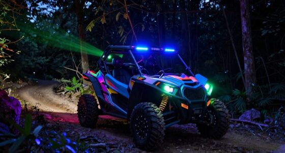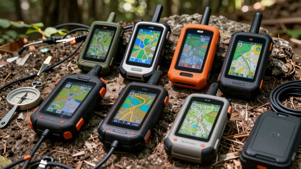

When selecting an off road mapping GPS device, durability, accuracy, and usability in rugged environments are key. The Garmin eTrex 32x stands out as the best overall choice for its reliability and detailed maps, while the Garmin Montana 750i impresses with satellite communication and camera features. For those needing a larger, glove-friendly screen, the Garmin Tread 2 offers a balanced mix of usability and advanced features. Buyers often face tradeoffs between ruggedness, screen size, and satellite connectivity. Continue reading for a detailed breakdown of these options and what to consider before buying.

Get business pricing on garage and car supplies
- Business-only prices and quantity discounts
- Tax-exempt purchasing
- Multiple users, one account, clear invoices
Complete the kit


Key Takeaways
- The top picks differ mainly in screen size, satellite connectivity, and ruggedness, catering to various off-road needs.
- The Garmin Montana 750i balances advanced communication features with durability, making it ideal for remote adventures.
- Size and interface design are critical; larger screens like the Tread 2 improve usability but may sacrifice portability.
- Most devices include preloaded maps, but verifying coverage and update options is essential for long-term use.
- Tradeoffs often involve choosing between rugged features and ease of use; understanding your specific terrain helps guide the decision.
| Garmin eTrex 32x Rugged Handheld GPS Navigator |  | Best Overall Rugged Handheld for Versatile Outdoor Use | Display: 2.2-inch sunlight-readable color display, 240 x 320 pixels | Maps: Preloaded Topo Active maps with routable roads and trails | Satellite Support: GPS and GLONASS | VIEW ON AMAZON | See Our Full Breakdown |
| Garmin Montana 750i Rugged GPS Handheld with InReach Satellite Technology and 8MP Camera |  | Best for Global Connectivity and Field Documentation | Display: 5-inch touchscreen | Camera: 8-megapixel | Construction: Military-grade | VIEW ON AMAZON | See Our Full Breakdown |
| Garmin Montana 700i Rugged GPS Handheld with Built-in inReach Satellite Technology 5″ Color Touchscreen |  | Best for Versatile Off-Road Navigation with Global Communication | Display: 5-inch color touchscreen | Mapping: Preloaded TopoActive and City Navigator | Satellite Communication: inReach | VIEW ON AMAZON | See Our Full Breakdown |
| Garmin Tread Powersport Off-Road Navigator, 5.5″ Display |  | Best Rugged Off-Road Navigator for Extreme Terrains | Display Size: 5.5 inches | Water Resistance: IPX7 | Maps Preloaded: Topographic and street maps of North America | VIEW ON AMAZON | See Our Full Breakdown |
| Garmin Tread 2 Powersport Navigator, 6″ Glove-Friendly Display |  | Best for High-Res Off-Road Trail Navigation and Live Tracking | Display Size: 6 inches | Water Resistance: IP67 | Maps Included: OpenStreetMap, U.S. Forest Service, City Navigator | VIEW ON AMAZON | See Our Full Breakdown |
| Garmin Tread XL Overland All-Terrain Navigator |  | Best for Rugged, Large-Screen Off Road Navigation | Display: 10-inch ultrabright | Water Resistance: IP67 (dust tight, water-resistant up to 1 meter for 30 minutes) | Maps: Preloaded topographic maps, USFS Motor Vehicle Use Maps, City Navigator, BirdsEye Satellite Imagery | VIEW ON AMAZON | See Our Full Breakdown |
| off road mapping gps device | Display | Connectivity | Water Resistance | Maps |
|---|---|---|---|---|
| Garmin eTrex 32x Rugged Handhe | 2.2-inch sunlight-readable color display, 240 x 320 pixels | — | — | Preloaded Topo Active maps with routable roads and trails |
| Garmin Montana 750i Rugged GPS | 5-inch touchscreen | Wi-Fi, Bluetooth, ANT+ | — | Preloaded TopoActive and City Navigator |
| Garmin Montana 700i Rugged GPS | 5-inch color touchscreen | — | IPX7 | — |
| Garmin Tread Powersport Off-Ro | — | Requires accessories for satellite communication | IPX7 | — |
| Garmin Tread 2 Powersport Navi | — | Wi-Fi, Bluetooth, Cellular | IP67 | — |
| Garmin Tread XL Overland All-T | 10-inch ultrabright | Built-in inReach satellite communication, Bluetooth, smartphone pairing | IP67 (dust tight, water-resistant up to 1 meter for 30 minutes) | Preloaded topographic maps, USFS Motor Vehicle Use Maps, City Navigator, BirdsEye Satellite Imagery |
More Details on Our Top Picks
Garmin eTrex 32x Rugged Handheld GPS Navigator
The Garmin eTrex 32x stands out for its durable, compact design paired with reliable multi-GNSS support, making it ideal for hikers and cyclists who need a dependable device in challenging environments. Compared with the larger, more feature-rich Montana 750i, the eTrex 32x offers a lighter footprint with long battery life, though it sacrifices a touchscreen. Its preloaded Topo Active maps and support for GPS and GLONASS ensure consistent tracking, especially in dense woods or rugged terrain. The absence of a touchscreen might be a drawback for those who prefer intuitive navigation, but its ruggedness and extended battery life make it a trusted companion for extended outdoor trips. This pick makes the most sense for users who prioritize durability and simple, reliable navigation over advanced features or a larger display.
Pros:- Rugged, weather-resistant design built for harsh outdoor conditions
- Preloaded with detailed, routable Topo Active maps
- Supports both GPS and GLONASS for reliable signal in difficult terrain
- Long battery life of up to 25 hours
Cons:- Small 2.2-inch display limits ease of use for detailed navigation
- No touchscreen, which may slow navigation for some users
- Requires frequent replacement or carrying extra AA batteries
Best for: Backcountry hikers and mountain bikers seeking a durable, long-lasting GPS device with detailed maps
Not ideal for: Casual users or those who prefer touchscreen interfaces, as it lacks a touchscreen and has a smaller display
- Display:2.2-inch sunlight-readable color display, 240 x 320 pixels
- Maps:Preloaded Topo Active maps with routable roads and trails
- Satellite Support:GPS and GLONASS
- Internal Memory:8 GB
- Expandable Storage:micro SD card slot
- Features:3-axis compass, barometric altimeter
- Battery Life:Up to 25 hours
Our verdict“This device suits outdoor enthusiasts who need a tough, dependable GPS with excellent battery life, and are comfortable with a smaller, non-touch display.”
Garmin Montana 750i Rugged GPS Handheld with InReach Satellite Technology and 8MP Camera
The Garmin Montana 750i excels in environments where communication and documentation are vital, thanks to its built-in InReach satellite technology and 8MP camera. Its large 5-inch touchscreen enhances usability compared to the smaller eTrex 32x, making it easier to view maps and capture images. The device’s global satellite connectivity enables two-way messaging and SOS, which surpasses the basic navigation offered by the Montana 700i, though it comes at a higher price point. Its rugged construction and extensive feature set make it suitable for remote expeditions, but the active satellite subscription can add ongoing costs. This device makes sense for adventurers who need reliable communication and documentation capabilities in remote regions, even if it’s more complex for casual hikers.
Pros:- Large, easy-to-use 5-inch touchscreen display
- Built-in InReach satellite technology for global messaging and SOS
- High-quality 8MP camera for capturing field images
- Supports multiple GNSS systems for flexible navigation
Cons:- Requires active satellite subscription for InReach features
- Higher price point compared to simpler GPS devices
- Complex interface might be overwhelming for casual users
Best for: Expeditioners and remote explorers requiring satellite communication, GPS navigation, and on-the-go documentation
Not ideal for: Casual outdoor users or those on a tight budget, as it involves subscription costs and complex features
- Display:5-inch touchscreen
- Camera:8-megapixel
- Construction:Military-grade
- Satellite Technology:InReach
- Maps:Preloaded TopoActive and City Navigator
- Navigation Sensors:3-axis compass, barometric altimeter
- Connectivity:Wi-Fi, Bluetooth, ANT+
- Battery Life:More than a week in Expedition mode
Our verdict“This device suits serious outdoor enthusiasts who need reliable satellite communication alongside detailed navigation and field documentation.”
Garmin Montana 700i Rugged GPS Handheld with Built-in inReach Satellite Technology 5″ Color Touchscreen
The Garmin Montana 700i offers a well-rounded package with a large 5-inch touchscreen, multi-GNSS support, and inReach satellite communication, making it ideal for serious off-road adventurers. Unlike the Montana 750i, it focuses on versatile navigation with preloaded maps and extensive sensors, but its higher price and subscription requirements for inReach features can be a barrier. The rugged, IPX7-rated design withstands tough conditions, and its long battery life supports extended expeditions. While this device is more complex than basic GPS units, it provides a reliable combination of navigation and communication for remote off-road trails. It suits those who need a dependable, multi-function device without sacrificing ruggedness or comprehensive mapping.
Pros:- Large, bright 5-inch color touchscreen
- Multi-GNSS support for accurate positioning
- Built-in inReach satellite tech for messaging and SOS
- Preloaded maps and durable, waterproof design
Cons:- Active satellite subscription required for inReach features
- Higher cost compared to basic GPS units
- May be complex for casual users unfamiliar with advanced features
Best for: Off-road explorers and trail riders seeking a rugged device with integrated satellite communication and advanced navigation features
Not ideal for: Users who prefer simple navigation without satellite subscription commitments or advanced sensors
- Display:5-inch color touchscreen
- Mapping:Preloaded TopoActive and City Navigator
- Satellite Communication:inReach
- GNSS Support:GPS, Galileo, multi-GNSS
- Sensors:3-axis compass, barometric altimeter
- Water Resistance:IPX7
- Battery Life:More than a week in expedition mode
Our verdict“This model fits off-road users who need a rugged, feature-rich device with global communication and detailed mapping in remote environments.”
Garmin Tread Powersport Off-Road Navigator, 5.5″ Display
The Garmin Tread Powersport Navigator is designed specifically for off-road and extreme terrain adventures, featuring a 5.5-inch display with preloaded topographic maps, land boundaries, and satellite imagery. Its rugged, weather-resistant build is perfect for side-by-side, ATV, and snowmobile riders who need detailed terrain data. Compared to the Tread 2, which offers a larger, high-resolution display, the Tread Powersport emphasizes durability and detailed off-road maps, though it requires additional purchases for satellite communicators and accessories. Its multiple sensors and gauges help navigate challenging environments, but setup can be complex, and some features depend on external devices or subscriptions. This device is best suited for riders who need reliable, specialized off-road mapping in demanding conditions.
Pros:- Rugged, weatherproof, and suitable for extreme conditions
- Preloaded with detailed topographic and trail maps
- Includes land boundaries and satellite imagery
- Built-in sensors for pitch, roll, barometric pressure, and altitude
Cons:- Requires separate purchase for satellite communicator and accessories
- Some features may need subscriptions or extra equipment
- Complex setup can be daunting for casual users
Best for: ATV, snowmobile, and off-road vehicle enthusiasts in need of rugged terrain maps and sensor data
Not ideal for: Casual explorers or those seeking a simple, beginner-friendly GPS device, as it involves complex setup and additional purchases
- Display Size:5.5 inches
- Water Resistance:IPX7
- Maps Preloaded:Topographic and street maps of North America
- Land Boundaries:U.S. public and private land boundaries
- Additional Features:U.S. Forest Service roads, BirdsEye Satellite Imagery, sensors for pitch and roll
- Connectivity:Requires accessories for satellite communication
Our verdict“This device is ideal for serious off-road riders who need detailed terrain data and rugged durability in extreme environments.”
Garmin Tread 2 Powersport Navigator, 6″ Glove-Friendly Display
The Garmin Tread 2 offers a larger 6-inch high-resolution, glove-friendly touchscreen designed for trail riders and off-road explorers who prioritize detailed maps and live ride tracking. Its compatibility with a variety of maps, including OpenStreetMap and U.S. Forest Service data, provides extensive options for off-road navigation. Compared with the Tread Powersport, the Tread 2 emphasizes a bigger, clearer display and live tracking, making it suitable for group rides and safety-conscious riders. Its IP67 water resistance and sensors like altimeter and compass add robustness, but subscription fees for premium maps and additional accessories can increase overall cost. This model fits riders who want a premium, easy-to-use device with advanced features and a large display for challenging terrains.
Pros:- Large, high-resolution, glove-friendly touchscreen
- Extensive mapping options including trail and satellite imagery
- Live tracking and group ride features for safety and coordination
- Rugged, IP67-rated weather resistance
Cons:- Subscription required for premium or outdoor maps
- Additional accessories like the Group Ride Radio sold separately
- Active cellular connection needed for some live features
Best for: Trail riders and off-road groups seeking a high-resolution, glove-friendly navigation device with live tracking
Not ideal for: Budget-conscious users who do not want ongoing subscription costs or complex setup
- Display Size:6 inches
- Water Resistance:IP67
- Maps Included:OpenStreetMap, U.S. Forest Service, City Navigator
- Additional Features:Digital elevation maps, satellite imagery, group ride tracking
- Connectivity:Wi-Fi, Bluetooth, Cellular
Our verdict“This device is best suited for serious trail riders and adventure groups who need a large, detailed display with live tracking in tough conditions.”
Garmin Tread XL Overland All-Terrain Navigator
The Garmin Tread XL Overland stands out for its massive 10-inch ultrabright display, making it ideal for off-road environments where visibility can be limited. Unlike smaller devices such as the Garmin Tread Powersport, this model offers a more comprehensive view of terrain and campgrounds, reducing the need to switch screens frequently. Its weather-resistant design (IP67) ensures durability in challenging conditions, but the complexity of setup and multiple device integrations can be daunting for users seeking quick, simple navigation. While preloaded maps—including topographic and satellite imagery—are extensive, some remote areas may still lack detailed data, and a subscription is required for the inReach satellite features to unlock global messaging and SOS. This pick makes the most sense for serious overlanders needing a rugged, large-display device with satellite communication, willing to handle the setup complexity and subscription costs.
Pros:- Massive 10-inch ultrabright display for excellent visibility in various lighting conditions
- Rugged, weather-resistant design (IP67) built to withstand harsh environments
- Preloaded with detailed topographic, satellite imagery, and campgrounds
- Built-in inReach satellite communication for global messaging and SOS
Cons:- Requires a subscription to access inReach satellite features, adding ongoing costs
- Setup can be complex due to multiple device integrations and configurations
- Limited map detail in some extremely remote regions
Best for: Experienced off-road enthusiasts and overlanders who prioritize a large, bright display and global satellite connectivity in rugged environments.
Not ideal for: Casual users or weekend explorers who prefer a simpler, plug-and-play device without ongoing subscription fees or complex setup.
- Display:10-inch ultrabright
- Water Resistance:IP67 (dust tight, water-resistant up to 1 meter for 30 minutes)
- Maps:Preloaded topographic maps, USFS Motor Vehicle Use Maps, City Navigator, BirdsEye Satellite Imagery
- Connectivity:Built-in inReach satellite communication, Bluetooth, smartphone pairing
- Additional Features:Built-in altimeter, barometer, compass, pitch and roll gauges, preloaded POIs and campgrounds
Our verdict“This device is best suited for experienced adventurers who need a large, durable GPS with satellite communication capabilities and are prepared for the higher cost and setup effort.”

How We Picked
These products were evaluated based on durability, accuracy, ease of use, screen size, satellite communication capabilities, and overall value. We prioritized devices that perform reliably in challenging outdoor conditions while offering features relevant to off-road navigation, such as detailed mapping and rugged construction. The ranking reflects a balance between advanced features and user-friendliness, ensuring options suit different levels of experience and specific off-road activities. Devices with comprehensive geographic coverage, long battery life, and robust build quality scored higher in our assessment.| off road mapping gps device | Maps | Battery Life | Connectivity | Water Resistance |
|---|---|---|---|---|
| Garmin eTrex 32x Rugged Handhe | Preloaded Topo Active maps with routable roads and trails | Up to 25 hours | — | — |
| Garmin Montana 750i Rugged GPS | Preloaded TopoActive and City Navigator | More than a week in Expedition mode | Wi-Fi, Bluetooth, ANT+ | — |
| Garmin Montana 700i Rugged GPS | — | More than a week in expedition mode | — | IPX7 |
| Garmin Tread Powersport Off-Ro | — | — | Requires accessories for satellite communication | IPX7 |
| Garmin Tread 2 Powersport Navi | — | — | Wi-Fi, Bluetooth, Cellular | IP67 |
| Garmin Tread XL Overland All-T | Preloaded topographic maps, USFS Motor Vehicle Use Maps, City Navigator, BirdsEye Satellite Imagery | — | Built-in inReach satellite communication, Bluetooth, smartphone pairing | IP67 (dust tight, water-resistant up to 1 meter for 30 minutes) |
Factors to Consider When Choosing Off Road Mapping Gps Device
Choosing the right off road mapping GPS device involves balancing several factors to match your specific outdoor needs. Beyond basic features, understanding how durability, screen size, connectivity, and map coverage influence your experience can help prevent costly mistakes. Making an informed choice ensures your device will perform reliably in remote, rugged environments while offering intuitive usability.Durability and Ruggedness
Off-road environments demand a device that withstands shocks, water, dust, and extreme temperatures. Look for devices with rugged construction, MIL-STD-810 certification, and waterproof ratings like IPX7 or IPX8. Failing to consider durability can lead to device failure in critical moments, especially during demanding outdoor adventures. Keep in mind that more rugged units tend to be bulkier and may cost more, so balance durability needs with portability.
Screen Size and Interface
Screen size impacts visibility and ease of use in outdoor conditions. Larger screens, like 6 inches, provide better map viewing and easier navigation with gloves, but can add bulk and weight. Smaller screens are more portable but may require more zooming or scrolling. An intuitive interface with quick access to key functions is equally important, especially when quick decisions are needed in rugged terrains. Consider your comfort with technology and typical environmental conditions when choosing size and interface complexity.
Satellite Connectivity and Maps
Devices with inReach or similar satellite communication enable real-time tracking and emergency communication, which is invaluable in remote areas. However, satellite features often come at a higher cost and may require additional subscriptions. Preloaded topographic maps are essential, but verify if updates and region coverage are included or available separately. Choosing between standalone navigation and communication features depends on your adventure scope and risk tolerance.
Battery Life and Power Options
Extended battery life is crucial for multi-day trips, especially when charging options are limited. Some devices use replaceable batteries, while others rely on rechargeable packs. Solar charging compatibility can extend usage in prolonged adventures, but adds cost and complexity. Consider your trip duration and charging opportunities to select a device whose power management matches your itinerary.
Cost and Value
Higher-priced units often include advanced features like satellite communication, larger displays, and better durability. However, they may offer features you don’t need, inflating the price without added benefit. Conversely, more affordable models might lack key features but serve well for casual or short-term outings. Evaluate your budget against your specific navigation needs to avoid overspending or under-equipping.
Frequently Asked Questions
Can I use these GPS devices without cellular service?
Yes, most off road GPS devices operate independently of cellular networks, relying on satellite signals for navigation. Devices with inReach or similar features do offer satellite communication for emergencies or tracking, but basic navigation functions typically don’t require cell service. Confirm that the device has comprehensive offline maps, which are essential for remote use, regardless of cellular connectivity.
How important is map updateability for off-road use?
Map updates are vital because they ensure your device includes the latest terrain data, trails, and road changes. Off-road environments often evolve, and outdated maps can lead to navigation errors or missed trails. Devices with easy update processes and access to free or affordable map updates are preferable, especially if you explore new or less-mapped areas regularly.
Are larger screens always better for off road navigation?
Larger screens improve visibility and facilitate easier map reading, particularly in bright outdoor conditions. However, they also tend to increase the device’s size and weight, which might be cumbersome during long hikes or rides. Smaller screens are more portable and less intrusive but require more zooming and scrolling. The best choice depends on your activity style and preference for visibility versus portability.
Should I prioritize satellite communication features?
Satellite communication adds a layer of safety for remote excursions, allowing for messaging or emergency signaling. If your adventures regularly take you far from cell coverage, investing in a device with inReach or similar technology makes sense. However, these features increase the device’s cost and complexity, so consider your risk level and whether the added safety justifies the expense.
What is the best way to extend battery life during extended trips?
To maximize battery life, choose devices with long-lasting batteries, and consider carrying spare batteries or portable chargers. Solar charging accessories can also help prolong device operation in sunny conditions. Reducing screen brightness, disabling unnecessary features, and using power-saving modes further stretch usage time. Planning ahead for power management ensures your device remains functional when you need it most.
Conclusion
For most users seeking a reliable all-around off road navigation experience, the Garmin eTrex 32x offers a balanced blend of durability, size, and detailed maps, making it the best overall choice. Those venturing into remote areas with the need for communication and camera capabilities should consider the Garmin Montana 750i for its satellite features. Beginners or casual explorers will find the Garmin Tread 2 more approachable with its larger, glove-friendly display. For dedicated off-road riders or overlanders, the larger, rugged models like the Garmin Tread XL provide extensive features tailored to specific terrains. Match your adventure style and needs with these options to choose the right device for your journeys.
As an affiliate, we earn on qualifying purchases.Halloween Picks
halloween