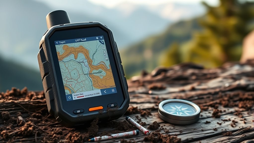

Finding the right off road GPS unit can make or break your outdoor adventures, especially when exploring rugged terrains. The best models like the Garmin Tread 2 Overland Edition stand out for their durability and comprehensive mapping features, while options like the Garmin Montana 700 excel for handheld versatility. However, buyers face tradeoffs between ruggedness, screen size, satellite communication, and price. Continue reading for a detailed breakdown of the top picks and what makes each one unique.

Get business pricing on garage and car supplies
- Business-only prices and quantity discounts
- Tax-exempt purchasing
- Multiple users, one account, clear invoices
Complete the kit


Key Takeaways
- The top-ranked Garmin Tread 2 models combine durability with advanced navigation features, making them ideal for serious off-roaders.
- Handheld options like the Garmin Montana 700 provide versatility for remote exploration but may lack large display features.
- Satellite communication technology, such as inReach, remains a key factor for safety-focused users venturing into remote areas.
- Ruggedness and screen size are often tradeoffs; larger screens improve visibility but can add bulk and weight.
- Pricing varies widely, with premium models offering extensive features at a premium, while budget options still deliver reliable navigation.
| Garmin Tread SxS GPS Navigator with Ultrabright Display and InReach Technology (Renewed) |  | Best for Advanced Off-Road Connectivity and Group Tracking | Display: 8-inch ultrabright touchscreen | Water Resistance: IP67 | Maps: Preloaded topographic maps of North and Central America | VIEW ON AMAZON | See Our Full Breakdown |
| Garmin Tread 2 – Overland Edition Rugged 8-Inch All-Terrain Navigator |  | Best for Off-Grid Explorers Who Value Preloaded Maps and Satellite Imagery | Display: 8-inch high-resolution touchscreen | Water Resistance: IP67 | Maps: Preloaded topographic, City Navigator, and satellite imagery | VIEW ON AMAZON | See Our Full Breakdown |
| Garmin Tread XL Overland All-Terrain Navigator |  | Best for Large-Screen Navigation and Group Tracking | Display: 10-inch ultrabright touchscreen | Water Resistance: IP67 | Maps: Preloaded topographic, USFS, and POIs | VIEW ON AMAZON | See Our Full Breakdown |
| Garmin GPSMAP 67i Rugged Handheld GPS with inReach Satellite Technology |  | Best for Long-Duration Remote Expeditions | Display: 3-inch sunlight-readable color | Satellite Technology: inReach® Satellite | Mapping: Preloaded TopoActive maps, satellite imagery | VIEW ON AMAZON | See Our Full Breakdown |
| Garmin Montana 700 Rugged GPS Handheld with 5″ Touchscreen and Routable Maps |  | Best for Versatile Multi-Activity Use in Tough Conditions | Screen Size: 5 inches | Resolution: 480 x 800 | Water Resistance: IPX7 | VIEW ON AMAZON | See Our Full Breakdown |
| Garmin Tread 2 – Overland Edition, Rugged 8-inch Satellite Imagery Bundle |  | Best Overall for Rugged Overland Navigation | Display: 8-inch high-resolution touchscreen | Water Resistance: IP67 | Included Accessories: USB Wall Charger, USB Type A to C cable, Cleaning Kit | VIEW ON AMAZON | See Our Full Breakdown |
| Garmin Tread 2 Powersport Navigator, 6″ Glove-Friendly Display |  | Best for Advanced Off-Road and Trail Enthusiasts | Display Size: 6 inches | Water Rating: IP67 | Connectivity: Wi-Fi, Bluetooth, Cellular | VIEW ON AMAZON | See Our Full Breakdown |
| Garmin Tread Powersport Off-Road Navigator with Group Ride Radio, 5.5″ Display (Renewed) |  | Best for Group Rides and Communication in Off-Road Adventures | Display: 5.5 inches | Weather Resistance: IPX7 | Maps: Preloaded topographic and street maps of North America | VIEW ON AMAZON | See Our Full Breakdown |
| Garmin Tread Powersport Off-Road Navigator, 5.5″ Display |  | Best for Rugged Off-Road Navigation with Basic Features | Display: 5.5 inches | Water Resistance: IPX7 | Maps: Preloaded topographic and street maps | VIEW ON AMAZON | See Our Full Breakdown |
| Garmin Montana 700i Rugged Handheld GPS with inReach Satellite, 5″ Touchscreen (Renewed) |  | Best for Remote Outdoor Adventures with Satellite Safety | Screen Size: 5 inches | Supported Maps: TopoActive, City Navigator | Satellite Technology: inReach, GPS, Galileo | VIEW ON AMAZON | See Our Full Breakdown |
| Garmin Tread 2 SxS Powersport Off-Road Navigator |  | Best Rugged Off-Road GPS with Group Ride Capabilities | Display: 8-inch high-resolution touchscreen | Water Resistance: IP67 | Maps: Preloaded topo maps of North and South America, satellite imagery, Adventure Roads, outdoor maps+ | VIEW ON AMAZON | See Our Full Breakdown |
| Garmin Tread® 2 – SxS Edition, Rugged 8″ All-Terrain Navigator |  | Best Trail and Land Management Features for Off-Road Enthusiasts | Display: 8-inch high-resolution touchscreen | Water Resistance: IP67 | Maps: OpenStreetMap, U.S. Forest Service, Adventure Roads and Trails, Outdoor Maps+ | VIEW ON AMAZON | See Our Full Breakdown |
| off road gps unit | Display | Connectivity | Water Resistance | Maps |
|---|---|---|---|---|
| Garmin Tread SxS GPS Navigator | 8-inch ultrabright touchscreen | InReach satellite, Bluetooth, cellular | IP67 | Preloaded topographic maps of North and Central America |
| Garmin Tread 2 | 8-inch high-resolution touchscreen | Wi-Fi, Bluetooth, cellular | IP67 | Preloaded topographic, City Navigator, and satellite imagery |
| Garmin Tread XL Overland All-T | 10-inch ultrabright touchscreen | Built-in inReach satellite | IP67 | Preloaded topographic, USFS, and POIs |
| Garmin GPSMAP 67i Rugged Handh | 3-inch sunlight-readable color | Wi-Fi, smartphone pairing | — | — |
| Garmin Montana 700 Rugged GPS | — | Bluetooth, ANT+, Wi-Fi | IPX7 | — |
| Garmin Tread 2 | 8-inch high-resolution touchscreen | — | IP67 | Preloaded topographic and road maps of North and South America |
| Garmin Tread 2 Powersport Navi | — | Wi-Fi, Bluetooth, Cellular | — | — |
| Garmin Tread Powersport Off-Ro | 5.5 inches | Group Ride Radio, Bluetooth, Wi-Fi | — | Preloaded topographic and street maps of North America |
| Garmin Tread Powersport Off-Ro | 5.5 inches | — | IPX7 | Preloaded topographic and street maps |
| Garmin Montana 700i Rugged Han | — | Wi-Fi, Bluetooth, ANT+ | — | — |
| Garmin Tread 2 SxS Powersport | 8-inch high-resolution touchscreen | Wi-Fi, Bluetooth, cellular (for group ride features) | IP67 | Preloaded topo maps of North and South America, satellite imagery, Adventure Roads, outdoor maps+ |
| Garmin Tread® 2 | 8-inch high-resolution touchscreen | — | IP67 | OpenStreetMap, U.S. Forest Service, Adventure Roads and Trails, Outdoor Maps+ |
More Details on Our Top Picks
Garmin Tread SxS GPS Navigator with Ultrabright Display and InReach Technology (Renewed)
This model stands out for its rugged build, large 8-inch ultrabright touchscreen, and integrated inReach satellite communication, making it a strong choice for off-road enthusiasts who need reliable connectivity. Compared with the Garmin Tread 2 Overland Edition, the SxS version offers more advanced communication features but requires an active subscription, adding ongoing costs. Its complex setup might be a hurdle for casual users, but for those who need real-time group tracking and global messaging, it delivers unmatched capabilities. The weather-resistant design and comprehensive maps make it suitable for extreme conditions, although some map data limitations could affect trail accuracy in remote areas.
Pros:- Rugged, weather-resistant design suitable for tough conditions
- Large, ultrabright display for easy visibility in sunlight
- Built-in inReach satellite communication for global connectivity
- Supports group ride tracking and trail navigation
Cons:- Requires an active subscription for satellite features, adding ongoing costs
- Setup can be complex for users unfamiliar with advanced GPS devices
Best for: Off-road riders and explorers who prioritize satellite communication and group tracking in challenging environments
Not ideal for: Casual trail users or beginners who want straightforward navigation without ongoing subscription costs
- Display:8-inch ultrabright touchscreen
- Water Resistance:IP67
- Maps:Preloaded topographic maps of North and Central America
- Connectivity:InReach satellite, Bluetooth, cellular
- Additional features:Group Ride Radio, altimeter, barometer, compass
Our verdict“This device works best for experienced off-road riders needing reliable communication and group tracking at a higher price point.”
Garmin Tread 2 – Overland Edition Rugged 8-Inch All-Terrain Navigator
The Garmin Tread 2 Overland Edition is tailored for outdoor adventurers who want preloaded detailed maps and satellite imagery. While it shares the rugged 8-inch touchscreen with the SxS, it emphasizes ease of use and map versatility, supporting outdoor maps, campgrounds, and satellite views. Compared to the Tread XL, it offers similar map content but without the built-in satellite communication, which means it’s less suited for remote communication but more affordable for purely navigation-focused use. The need for a subscription to access some premium maps can be a drawback, but its durable design and extensive map options make it ideal for off-grid exploration.
Pros:- Rugged, weatherproof design suitable for extreme conditions
- Preloaded topographic and satellite maps for detailed navigation
- Supports outdoor maps and campgrounds for comprehensive planning
- Durable mounting options included
Cons:- Subscription required for access to some premium map features
- Lacks built-in satellite communication for messaging or SOS
Best for: Overland travelers and trail riders seeking detailed maps and satellite imagery without satellite communication needs
Not ideal for: Users requiring real-time messaging or satellite connectivity for remote safety
- Display:8-inch high-resolution touchscreen
- Water Resistance:IP67
- Maps:Preloaded topographic, City Navigator, and satellite imagery
- Connectivity:Wi-Fi, Bluetooth, cellular
- Mounting:Heavy-duty suction cup with magnet lock
Our verdict“This GPS is perfect for explorers who prioritize detailed maps and satellite imagery over communication features.”
Garmin Tread XL Overland All-Terrain Navigator
The Garmin Tread XL Overland offers a substantial 10-inch display, making it ideal for users who need a large, clear view of trail maps and navigation data. Its extensive preloaded topographic maps and USFS data, combined with built-in satellite communication, make it suitable for serious off-road adventures. Compared with the 8-inch models like the Tread 2, the XL provides more screen real estate, but at a higher cost and increased size, which could be cumbersome for some users. The device’s comprehensive features cater to those who want detailed trail info along with group ride capabilities, though its price and size could be a barrier for casual users or those with limited vehicle space.
Pros:- Large 10-inch ultrabright display for easy trail viewing
- Preloaded with extensive maps and points of interest
- Built-in satellite communication for global connectivity
- Supports group ride tracking and detailed trail planning
Cons:- High price point may deter casual users
- Bulky design can be difficult to mount or carry in tight spaces
Best for: Off-road enthusiasts who need a large display for detailed navigation and group ride management
Not ideal for: Light users or those with limited space who prefer smaller, more portable devices
- Display:10-inch ultrabright touchscreen
- Water Resistance:IP67
- Maps:Preloaded topographic, USFS, and POIs
- Connectivity:Built-in inReach satellite
- Additional Features:Altimeter, barometer, compass
Our verdict“This pick suits serious off-roaders who prioritize a large screen and advanced group features over portability and cost.”
Garmin GPSMAP 67i Rugged Handheld GPS with inReach Satellite Technology
The Garmin GPSMAP 67i excels as a rugged handheld with extended battery life and global satellite coverage, making it the ideal companion for long expeditions into remote areas. Its smaller 3-inch sunlight-readable display is less suited for quick trail checks, but its multi-band GNSS and inReach technology provide reliable messaging and SOS capabilities worldwide. Compared with the larger, vehicle-mounted models like the Montana 700, the 67i offers more portability and longer battery life, though at the expense of screen size. Active satellite subscription is a must for messaging and SOS, which adds ongoing costs, but for solo explorers or serious trekkers, this device offers peace of mind in harsh environments.
Pros:- Rugged and highly durable for tough conditions
- Global satellite coverage for messaging and SOS
- Exceptional battery life supports extended use
- Preloaded TopoActive maps and satellite imagery
Cons:- High cost and active subscription needed for full features
- Small display limits quick navigation and map viewing
Best for: Backcountry explorers and long-distance trekkers needing reliable communication and extended battery life
Not ideal for: Casual day hikers or users who prefer larger screens for quick navigation
- Display:3-inch sunlight-readable color
- Satellite Technology:inReach® Satellite
- Mapping:Preloaded TopoActive maps, satellite imagery
- Connectivity:Wi-Fi, smartphone pairing
- Battery Life:Up to 165 hours in tracking mode
Our verdict“This device is well-suited for serious remote expeditions where long battery life and satellite connectivity outweigh screen size.”
Garmin Montana 700 Rugged GPS Handheld with 5″ Touchscreen and Routable Maps
The Garmin Montana 700 offers a versatile 5-inch glove-friendly touchscreen and support for multiple GNSS systems, making it suitable for a wide range of outdoor activities from hiking to ATV riding. Its rugged, MIL-STD 810 rated construction ensures durability in harsh environments. Compared to larger models like the Tread XL, the Montana 700 is more portable but still packs extensive features like routable maps, satellite imagery, and wireless data sharing. The shorter battery life of 18 hours and its weight may be drawbacks for long-distance users, but its support for multiple activities makes it a flexible choice for outdoor enthusiasts who need reliable, detailed navigation in a compact form.
Pros:- Rugged, MIL-STD 810 rated construction for durability
- Glove-friendly 5-inch touchscreen for easy use
- Supports multiple GNSS systems for precise location
- Wireless connectivity for satellite imagery and data sharing
Cons:- Heavy and somewhat bulky for handheld use
- Limited battery life for extended long-distance trips
Best for: Outdoor adventurers engaging in multiple activities who need a durable, portable GPS with versatile features
Not ideal for: Users seeking ultra-long battery life or those preferring larger screens for quick trail reference
- Screen Size:5 inches
- Resolution:480 x 800
- Water Resistance:IPX7
- Connectivity:Bluetooth, ANT+, Wi-Fi
- Battery Life:18 hours
- Supported Maps:TopoActive with routable maps
Our verdict“This device suits users needing a rugged, multi-activity GPS that balances portability with advanced features, despite its weight and battery limitations.”
Garmin Tread 2 – Overland Edition, Rugged 8-inch Satellite Imagery Bundle
The Garmin Tread 2 Overland Edition stands out for its large, high-resolution 8-inch display, making it ideal for serious overlanders needing a detailed view of challenging terrains. Compared with the smaller Garmin Tread Powersport models, this unit offers a more expansive screen, enhancing situational awareness in remote environments. Its durability and IP67 water resistance make it suitable for extreme conditions, while preloaded topographic maps and downloadable satellite imagery provide comprehensive off-road data. However, the satellite imagery requires Wi-Fi downloads, and the bundle’s premium price may be a barrier for some. This model excels for those who prioritize detailed visuals and rugged reliability in their expeditions but is less suited for casual users due to cost and connectivity constraints.
Pros:- Massive 8-inch high-resolution touchscreen for clear visibility
- Preloaded topographic and road maps of North and South America
- Downloadable satellite imagery without subscription
Cons:- Requires Wi-Fi for satellite imagery downloads, limiting real-time updates
- High cost due to premium features and bundle accessories
Best for: Overlanders and expedition travelers who need a large, durable device with detailed satellite imagery for remote terrains
Not ideal for: Casual off-road enthusiasts or weekend riders who prefer smaller, more affordable GPS units with simpler features
- Display:8-inch high-resolution touchscreen
- Water Resistance:IP67
- Included Accessories:USB Wall Charger, USB Type A to C cable, Cleaning Kit
- Maps:Preloaded topographic and road maps of North and South America
- Satellite Imagery:Downloadable high-resolution images without subscription
Our verdict“This device is perfect for experienced overlanders seeking a rugged, large-screen GPS with detailed imagery, despite its higher price and download limitations.”
Garmin Tread 2 Powersport Navigator, 6″ Glove-Friendly Display
The Garmin Tread 2 Powersport Navigator with its 6-inch glove-friendly display offers a balanced mix of ruggedness and detailed mapping, making it suitable for riders who want versatile trail and off-road navigation. Its compatibility with a variety of outdoor maps, including US Forest Service and Adventure Roads, makes it more adaptable than smaller or simpler models. While it supports live tracking, group ride sharing, and satellite imagery, some features depend on active subscriptions and cellular connectivity, which could limit its utility in remote areas. Compared to the Tread 2 Overland Edition, this model sacrifices screen size for portability and a more specific focus on trail riding, but it involves ongoing costs for premium maps and services.
Pros:- Rugged, weather-resistant design suitable for extreme conditions
- Glove-friendly touchscreen for easy operation in the field
- Supports a wide range of outdoor maps including satellite imagery
Cons:- Subscription required for premium maps and some features
- Dependence on cellular and Bluetooth connections limits offline functionality
Best for: Trail riders and off-road motorsport enthusiasts who need a rugged, feature-rich device with live tracking and map customization
Not ideal for: Casual hikers or casual off-road users who prefer simple devices without subscription commitments
- Display Size:6 inches
- Water Rating:IP67
- Connectivity:Wi-Fi, Bluetooth, Cellular
- Maps Included:OpenStreetMap, US Forest Service, Adventure Roads
- Additional Features:Digital elevation, land info, campgrounds, satellite imagery
Our verdict“Ideal for trail riders needing a durable, feature-packed GPS with live tracking and map flexibility, provided they are comfortable with ongoing subscriptions.”
Garmin Tread Powersport Off-Road Navigator with Group Ride Radio, 5.5″ Display (Renewed)
The Garmin Tread Powersport Off-Road Navigator with its 5.5-inch display emphasizes communication with built-in group ride radio and satellite messaging, making it a strong choice for organized off-road groups. Its rugged design and preloaded maps of North America support trail riding and off-road exploration, but the device’s reliance on active subscriptions for certain features and its complex setup may deter casual users. Unlike other models that focus purely on navigation, this device integrates communication, which is essential for group coordination but adds complexity and cost. It’s best suited for groups or serious riders who want integrated radio and satellite messaging in a durable package, not for casual or solo users.
Pros:- Rugged, weather-resistant build suitable for tough conditions
- Group Ride Radio and satellite messaging for coordinated off-road activity
- Preloaded topographic maps of North America
Cons:- Requires active satellite subscriptions for some features
- Setup complexity and higher price may be challenging for casual users
Best for: Off-road groups and riders who prioritize communication and safety features alongside navigation
Not ideal for: Solo riders or casual off-road users who do not need integrated radio or complex setup
- Display:5.5 inches
- Weather Resistance:IPX7
- Maps:Preloaded topographic and street maps of North America
- Connectivity:Group Ride Radio, Bluetooth, Wi-Fi
Our verdict“Designed for organized off-road groups, this device combines navigation with communication, but may be overkill for solo or casual riders.”
Garmin Tread Powersport Off-Road Navigator, 5.5″ Display
The Garmin Tread Powersport Off-Road Navigator offers a rugged and straightforward 5.5-inch touchscreen, making it a reliable option for riders who want essential navigation features without extra complexity. Its preloaded topographic and street maps of North and Central America, along with land boundary info, make it suitable for varied terrain. Compared to the Group Ride model, this version omits communication features, focusing purely on navigation and basic sensors like altimeter and compass. Its reliance on separate accessories and possible subscription fees for satellite imagery are notable tradeoffs, but its simplicity suits users who prefer a dedicated, no-frills GPS device.
Pros:- Durable, IPX7 water resistance for rugged conditions
- Preloaded detailed maps with land boundaries
- Supports various Garmin accessories for expanded functionality
Cons:- Additional purchases needed for accessories like satellite communicators
- Subscription may be required for satellite imagery features
Best for: Riders seeking a durable, straightforward GPS for off-road navigation without advanced communication features
Not ideal for: Groups or riders who need integrated radio and messaging capabilities or advanced tracking
- Display:5.5 inches
- Water Resistance:IPX7
- Maps:Preloaded topographic and street maps
- Additional Features:Land boundaries, altimeter, compass
Our verdict“A dependable, no-fuss GPS for off-road riders who prioritize basic navigation and durability over communication features.”
Garmin Montana 700i Rugged Handheld GPS with inReach Satellite, 5″ Touchscreen (Renewed)
The Garmin Montana 700i combines military-grade durability with comprehensive satellite communication, making it ideal for remote explorers. Its 5-inch touchscreen offers large, clear visuals, while inReach technology provides SOS, messaging, and tracking in areas without cellular coverage. Compared with the Tread series, this handheld emphasizes safety and multi-GNSS support, which is advantageous for multi-terrain navigation in wilderness. The need for an active satellite subscription and the refurbished status may be drawbacks, but its rugged build and extensive sensor suite make it a favorite for serious adventurers who venture off-grid where safety is paramount.
Pros:- Military-grade durability for tough environments
- Large, easy-to-read 5-inch touchscreen
- Supports inReach satellite SOS and messaging for safety
Cons:- Active satellite subscription required for inReach features
- Refurbished units may have limited warranty and unknown wear
Best for: Remote explorers and wilderness adventurers who require reliable satellite communication and rugged durability
Not ideal for: Casual hikers or users who do not need satellite communication or are okay with non-refurbished devices
- Screen Size:5 inches
- Supported Maps:TopoActive, City Navigator
- Satellite Technology:inReach, GPS, Galileo
- Connectivity:Wi-Fi, Bluetooth, ANT+
- Additional Features:Rugged construction, inReach SOS, multi-GNSS support
Our verdict“Perfect for off-grid explorers needing rugged durability combined with satellite communication for safety and messaging.”
Garmin Tread 2 SxS Powersport Off-Road Navigator
The Garmin Tread 2 SxS Powersport stands out for its rugged build and comprehensive off-road features, making it a top choice for serious SxS riders who need durability and detailed navigation. Compared with the Garmin Tread® 2 – SxS Edition, this model emphasizes group ride integration with live location sharing, which is ideal for team adventures. However, its reliance on a subscription for premium maps can add ongoing costs, and some map updates may lag behind real-world changes. The 8-inch high-resolution touchscreen, combined with preloaded topo maps and satellite imagery, ensures clear, detailed navigation even in remote areas. Its IP67 rating guarantees water and dust resistance, suitable for extreme weather conditions. The included accessories for mounting and power supply add convenience, but the group ride radio accessory is sold separately, which could be a downside for those seeking an all-in-one solution.
Pros:- Rugged design built to withstand extreme weather and off-road conditions
- Preloaded detailed topo maps and satellite imagery for precise navigation
- Supports group ride tracking and live location sharing
Cons:- Subscription required for access to premium outdoor maps+
- Some map data updates may be delayed or limited
- Group ride radio accessory sold separately, adding extra cost
Best for: Off-road enthusiasts and SxS riders who need durable, feature-rich navigation with group communication capabilities
Not ideal for: Casual riders or those on a tight budget who want basic GPS without subscription fees or advanced group features
- Display:8-inch high-resolution touchscreen
- Water Resistance:IP67
- Maps:Preloaded topo maps of North and South America, satellite imagery, Adventure Roads, outdoor maps+
- Connectivity:Wi-Fi, Bluetooth, cellular (for group ride features)
- Sensors:Altimeter, barometer, compass, pitch/roll gauges
- Battery:Power Pack 5000mAh included
Our verdict“This GPS is best suited for serious off-road users who prioritize durability, detailed mapping, and group coordination despite ongoing costs.”
Garmin Tread® 2 – SxS Edition, Rugged 8″ All-Terrain Navigator
The Garmin Tread 2 – SxS Edition excels for users who want detailed trail navigation and land info, especially compared to the Garmin Tread SxS GPS Navigator with Ultrabright Display, which focuses more on visibility in bright conditions. This model offers a wider array of preloaded maps, including U.S. Forest Service data and private/public land boundaries, making it ideal for land management and trail exploration. Its digital elevation maps and satellite imagery enhance terrain awareness, but the reliance on a Bluetooth connection and smartphone app for full functionality can be a hassle in areas with poor cell coverage. The 8-inch high-resolution touchscreen ensures clarity, and the rugged IP67 rating guarantees resilience against weather and dust. It includes a tube mount kit and bare wire power cable, designed for flexible installation in vehicles or ATVs, but lacks built-in radio features, which some users might miss for real-time communication.
Pros:- Extensive preloaded maps, including U.S. Forest Service and private land info
- Digital elevation maps and satellite imagery for terrain awareness
- Supports live tracking and provides thousands of campgrounds across the U.S.
Cons:- Subscription needed for premium map content
- Full functionality depends on a smartphone app and Bluetooth connection
- Limited map accuracy in some regions, requiring updates
Best for: Trail riders and land managers seeking detailed terrain data, land boundaries, and satellite imagery for exploration and planning
Not ideal for: Casual hikers or riders preferring standalone devices without reliance on smartphone apps or Bluetooth connections
- Display:8-inch high-resolution touchscreen
- Water Resistance:IP67
- Maps:OpenStreetMap, U.S. Forest Service, Adventure Roads and Trails, Outdoor Maps+
- Features:Digital elevation maps, land info, campgrounds, satellite imagery
- Sensors:Altimeter, barometer, compass, pitch/roll gauges
- Includes:Tube mount kit, bare wire power cable
Our verdict“This pick makes the most sense for off-road users who value detailed land data, trail navigation, and terrain visualization over standalone simplicity.”

How We Picked
This selection process focused on evaluating each device’s durability, usability, and navigation accuracy in off-road conditions. We prioritized GPS units that offer rugged construction, clear displays, and reliable satellite connectivity, especially in remote environments. Additional factors included ease of use, battery life, and the availability of specialized features like topo maps or group communication. Products were ranked based on how well they balance these qualities against price, ensuring options suited for different levels of off-road enthusiasts and professional users alike.Factors to Consider When Choosing Off Road Gps Units
Choosing an off road GPS unit involves balancing several key factors that influence performance, durability, and usability. Understanding these considerations can help avoid common pitfalls like overspending on unnecessary features or selecting a device unable to withstand harsh conditions. Here are the main factors to keep in mind when selecting your ideal off-road navigation tool.Ruggedness and Build Quality
For off-road use, a GPS unit must endure shocks, water, dust, and extreme temperatures. Look for devices with military-grade ratings or reinforced casing, which provide peace of mind in harsh environments. Cheaper, consumer-grade units may fail under tough conditions, so investing in a rugged model is often worthwhile if you plan frequent or intense off-road adventures.
Display Size and Visibility
Clear visibility is essential when navigating rugged terrains. Larger screens offer easier map reading and better detail, especially in bright sunlight, but can add weight and bulk. Touchscreen functionality enhances usability, yet some users prefer physical buttons for glove use. Consider your typical environment and preferences when choosing screen features.
Navigation Features and Maps
Accurate, detailed maps are the backbone of effective off-road navigation. Look for units with topo maps, trail overlays, and routable features tailored to your activity—whether overlanding, trail riding, or hiking. Some models provide preloaded maps, while others allow for customizable downloads. Evaluate whether the device supports the specific terrains you plan to explore.
Satellite Connectivity and Safety Features
In remote areas, satellite communication devices like inReach can be lifesavers, offering SOS capabilities and two-way messaging. Not all GPS units include such features, so consider whether safety tech matches your adventure style. Devices with satellite connectivity tend to cost more but provide significant peace of mind.
Battery Life and Power Options
Long-lasting battery life is vital during extended trips away from charging sources. Look for units with multiple power options, such as rechargeable batteries or replaceable AA cells. Some models offer power-saving modes or external battery packs, which can extend usability in remote settings.
Frequently Asked Questions
Can I use these GPS units for both off-road and on-road navigation?
Many off-road GPS units, especially those from Garmin, are versatile enough to handle on-road navigation as well. They typically support routing, turn-by-turn directions, and road maps, making them suitable for mixed use. However, some models focus more on rugged terrain features and may lack detailed street maps, so check the specifications if on-road capability is important for your trips.
Are satellite communication features like inReach necessary for off-road use?
Satellite communication features significantly enhance safety, especially in remote areas where cell service is unavailable. These features enable SOS alerts, two-way messaging, and location sharing, which can be crucial in emergencies. While they add to the cost, they are highly recommended for serious off-road adventurers or those venturing into isolated regions regularly.
How important is screen size versus ruggedness?
Screen size directly affects readability and ease of use, particularly when navigating challenging terrains or in bright sunlight. Larger screens are generally better for detailed map viewing but tend to be bulkier and less rugged. Conversely, smaller, more rugged units offer durability but may sacrifice some usability. Your choice depends on balancing these priorities based on your activity style.
Do I need a GPS device with preloaded maps, or can I add my own?
Many off-road GPS units come with preloaded maps tailored for specific activities, which simplifies setup. However, most also support adding custom maps or updates via SD cards or downloads, offering flexibility. Consider whether you prefer a ready-to-go device or one that can be customized for specific terrains or detailed trail data.
What’s the typical battery life I should expect from these devices?
Battery life varies widely, from around 8 hours on compact models to over 20 hours on high-capacity units with power-saving features. For extended trips, look for devices with replaceable batteries or external power options. Remember, heavier usage of features like GPS tracking and backlighting will drain batteries faster, so plan accordingly.
Conclusion
For the most demanding off-road explorers who need ruggedness and advanced features, the Garmin Tread 2 – Overland Edition offers a comprehensive experience. Budget-conscious users seeking reliable core navigation may find the Garmin Montana 700 to be the best value. Beginners or casual adventurers can opt for simpler, more user-friendly options like the Garmin Tread Powersport Navigator. For those prioritizing safety, models with built-in satellite communication like the Garmin GPSMAP 67i provide peace of mind. Ultimately, your choice depends on your activity level, terrain, and safety needs—this roundup helps match each model to the right adventure style.
Fall Picks
fall essentials
As an affiliate, we earn on qualifying purchases.